 |
|
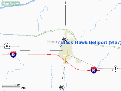
Location
& QuickFacts
|
FAA
Information Effective: |
2007-07-05 |
|
Airport
Identifier: |
9IS7 |
|
Airport
Status: |
Operational |
|
Longitude/Latitude: |
090-10-05.4280W/41-27-20.1240N
-90.168174/41.455590 (Estimated) |
|
Elevation: |
630 ft / 192.02 m (Estimated) |
|
Land: |
2 acres |
|
From
nearest city: |
0 nautical miles W of Geneseo, IL |
|
Location: |
Henry County, IL |
|
Magnetic Variation: |
01E (1985) |
Owner
& Manager
|
Ownership: |
Privately
owned |
|
Owner: |
Black Hawk Helicopters Inc. |
|
Address: |
205 N Stewart St
Geneseo, IL 61254 |
|
Phone
number: |
309-944-4322 |
|
Manager: |
Michael J. Bellovics |
|
Address: |
205 N Stewart St
Geneseo, IL 61254 |
|
Phone number: |
309-944-3547 |
Airport Operations and Facilities
|
Airport Use: |
Private |
|
Wind indicator: |
Yes |
|
Segmented Circle: |
No |
|
Control Tower: |
No |
|
Sectional chart: |
Chicago |
|
Region: |
AGL - Great Lakes |
|
Boundary ARTCC: |
ZAU - Chicago |
|
Tie-in FSS: |
IKK - Kankakee |
|
FSS Toll Free: |
1-800-WX-BRIEF |
Airport Services
|
Runway Information
Helipad H1
|
Dimension: |
60
x 60 ft / 18.3 x 18.3 m |
|
Surface: |
TURF, |
|
|
Runway H1 |
Runway |
|
Traffic
Pattern: |
Left |
Left |
|
Radio Navigation
Aids
|
ID |
Type |
Name |
Ch |
Freq |
Var |
Dist |
|
EZI |
NDB |
Kewanee |
|
245.00 |
01E |
18.0 nm |
|
BOZ |
NDB |
Whiteside |
|
254.00 |
01E |
23.1 nm |
|
CWI |
NDB |
Clinton |
|
377.00 |
01E |
23.5 nm |
|
OQW |
NDB |
Maquoketa |
|
386.00 |
02E |
44.1 nm |
|
VYS |
NDB |
Valley |
|
230.00 |
00W |
46.4 nm |
|
GBG |
VOR/DME |
Galesburg |
035X |
109.80 |
03E |
33.4 nm |
|
PLL |
VOR/DME |
Polo |
049X |
111.20 |
03E |
42.1 nm |
|
DDD |
VOR/DME |
Port City |
112X |
116.50 |
01E |
44.5 nm |
|
CVA |
VORTAC |
Davenport |
085X |
113.80 |
04E |
20.8 nm |
|
MZV |
VORTAC |
Moline |
091X |
114.40 |
05E |
22.7 nm |
|
BDF |
VORTAC |
Bradford |
094X |
114.70 |
00E |
31.7 nm |
|
PIA |
VORTAC |
Peoria |
099X |
115.20 |
04E |
49.6 nm |
|
DVN |
VOT |
Davenport Municipal |
|
111.80 |
|
21.0 nm |
Remarks
- PLINE
100' SOUTH; RR 105' NORTH.
- PRFDD
APCH/DEPT OPNS ARE FM 270 DEG TO 030 DEG; AREA IS MKD; WIND INDICATOR
IS MNTD.
Based
Aircraft
|
Aircraft
based on field: |
3 |
|
Helicopters: |
3 |
Black Hawk Heliport
Address:
Henry County, IL
Tel:
309-944-4322,
309-944-3547
Images
and information placed above are from
http://www.airport-data.com/airport/9IS7/
We
thank them for the data!
| General
Info |
| Country |
United
States |
| State |
ILLINOIS
|
| FAA ID |
9IS7 |
| Latitude |
41-27-20.124N
|
| Longitude |
090-10-05.428W
|
| Elevation |
630 feet
|
| Near City |
GENESEO
|
We don't guarantee the information is fresh and accurate. The data may
be wrong or outdated.
For more up-to-date information please refer to other sources.
|
|


