 |
|
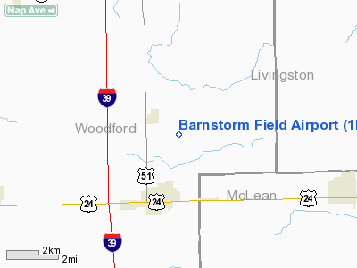
Location
& QuickFacts
|
FAA
Information Effective: |
2007-07-05 |
|
Airport
Identifier: |
1IL0 |
|
Airport
Status: |
Operational |
|
Longitude/Latitude: |
089-00-04.0000W/40-46-30.0000N
-89.001111/40.775000 (Estimated) |
|
Elevation: |
731 ft / 222.81 m (Estimated) |
|
Land: |
0 acres |
|
From
nearest city: |
3 nautical miles N of El Paso, IL |
|
Location: |
Woodford County, IL |
|
Magnetic Variation: |
01W (1995) |
Owner & Manager
|
Ownership: |
Privately owned |
|
Owner: |
David Burroughs |
|
Address: |
508 Amherst St
Normal, IL 61761 |
|
Phone number: |
309-452-8220 |
|
Manager: |
David Burroughs |
|
Address: |
508 Amherst St
Normal, IL 61761 |
|
Phone number: |
309-452-8220 |
Airport
Operations and Facilities
|
Airport
Use: |
Private |
|
Wind
indicator: |
Yes |
|
Segmented Circle: |
No |
|
Control
Tower: |
No |
|
Sectional chart: |
Chicago |
|
Region: |
AGL - Great Lakes |
|
Boundary
ARTCC: |
ZAU - Chicago |
|
Tie-in
FSS: |
IKK - Kankakee |
|
FSS
Toll Free: |
1-800-WX-BRIEF |
|
Runway Information
Runway 09/27
|
Dimension: |
2650
x 70 ft / 807.7 x 21.3 m |
|
Surface: |
TURF, |
|
|
Runway 09 |
Runway 27 |
|
Traffic
Pattern: |
Left |
Left |
|
Displaced
threshold: |
450.00 ft |
0.00 ft |
|
Obstruction: |
30 ft pline |
|
|
Radio Navigation
Aids
|
ID |
Type |
Name |
Ch |
Freq |
Var |
Dist |
|
PI |
NDB |
Tungg |
|
356.00 |
01E |
28.8 nm |
|
VYS |
NDB |
Valley |
|
230.00 |
00W |
35.5 nm |
|
OIX |
NDB |
Ottawa |
|
266.00 |
01E |
35.9 nm |
|
AAA |
NDB |
Abraham |
|
329.00 |
00E |
40.0 nm |
|
PNT |
VOR/DME |
Pontiac |
033X |
109.60 |
03E |
12.5 nm |
|
BMI |
VOR/DME |
Bloomington |
019X |
108.20 |
03E |
18.0 nm |
|
RBS |
VOR/DME |
Roberts |
115X |
116.80 |
02E |
39.9 nm |
|
BDF |
VORTAC |
Bradford |
094X |
114.70 |
00E |
35.3 nm |
|
PIA |
VORTAC |
Peoria |
099X |
115.20 |
04E |
36.5 nm |
Remarks
- OWNER
DESIRES ARPT NOT BE CHARTED.
- SEE
AIRSPACE CASE 97-AGL-241-NRA
Based
Aircraft
|
Aircraft
based on field: |
2 |
|
Single
Engine Airplanes: |
2 |
Barnstorm Field Airport
Address:
Woodford County, IL
Tel:
309-452-8220
Images
and information placed above are from
http://www.airport-data.com/airport/1IL0/
We
thank them for the data!
| General
Info |
| Country |
United
States |
| State |
ILLINOIS
|
| FAA ID |
1IL0 |
| Latitude |
40-46-30.000N
|
| Longitude |
089-00-04.000W
|
| Elevation |
731 feet
|
| Near City |
EL PASO
|
We don't guarantee the information is fresh and accurate. The data may
be wrong or outdated.
For more up-to-date information please refer to other sources.
|
|


