 |
|
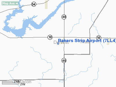
Location
& QuickFacts
|
FAA
Information Effective: |
2007-07-05 |
|
Airport
Identifier: |
7LL4 |
|
Airport
Status: |
Operational |
|
Longitude/Latitude: |
088-45-32.2610W/40-07-02.1280N
-88.758961/40.117258 (Estimated) |
|
Elevation: |
715 ft / 217.93 m (Estimated) |
|
Land: |
0 acres |
|
From
nearest city: |
1 nautical miles SW of Weldon, IL |
|
Location: |
De Witt County, IL |
|
Magnetic Variation: |
00E (1985) |
Owner & Manager
|
Ownership: |
Privately owned |
|
Owner: |
Clarence Lee Baker |
|
Address: |
Rr 1, Box 1
Weldon, IL 61882 |
|
Phone number: |
217-736-2342 |
|
Manager: |
Clarence Lee Baker |
|
Address: |
Rr 1, Box 1
Weldon, IL 61882 |
|
Phone number: |
217-736-2342 |
Airport Operations and Facilities
|
Airport Use: |
Private |
|
Wind indicator: |
Yes |
|
Segmented Circle: |
No |
|
Control Tower: |
No |
|
Landing fee charge: |
No |
|
Sectional chart: |
Chicago |
|
Region: |
AGL - Great Lakes |
|
Boundary ARTCC: |
ZAU - Chicago |
|
Tie-in FSS: |
STL - Saint Louis |
|
FSS on Airport: |
No |
|
FSS Phone: |
636-536-2980 |
|
FSS Toll Free: |
1-800-WX-BRIEF |
Airport Services
|
Airframe
Repair: |
NONE |
|
Power
Plant Repair: |
NONE |
|
Runway Information
Runway N/S
|
Dimension: |
2200
x 100 ft / 670.6 x 30.5 m |
|
Surface: |
TURF, |
|
|
Runway N |
Runway S |
|
Traffic
Pattern: |
Left |
Left |
|
Obstruction: |
35 ft bldg, 150.0 ft from runway |
|
|
Radio Navigation
Aids
|
ID |
Type |
Name |
Ch |
Freq |
Var |
Dist |
|
AAA |
NDB |
Abraham |
|
329.00 |
00E |
26.7 nm |
|
HMJ |
NDB |
Homer |
|
281.00 |
01E |
37.5 nm |
|
LQ |
NDB |
Licol |
|
375.00 |
01W |
40.8 nm |
|
SYZ |
NDB |
Shelbyville |
|
365.00 |
01E |
42.9 nm |
|
TAZ |
NDB |
Taylorville |
|
395.00 |
00E |
43.6 nm |
|
PI |
NDB |
Tungg |
|
356.00 |
01E |
48.2 nm |
|
MT |
NDB |
Zebre |
|
347.00 |
00E |
48.8 nm |
|
BMI |
VOR/DME |
Bloomington |
019X |
108.20 |
03E |
23.2 nm |
|
RBS |
VOR/DME |
Roberts |
115X |
116.80 |
02E |
39.0 nm |
|
PNT |
VOR/DME |
Pontiac |
033X |
109.60 |
03E |
42.3 nm |
|
MTO |
VOR/DME |
Mattoon |
031X |
109.40 |
03E |
44.2 nm |
|
CMI |
VORTAC |
Champaign |
037X |
110.00 |
03E |
22.8 nm |
|
DEC |
VORTAC |
Decatur |
119X |
117.20 |
03E |
23.3 nm |
|
CAP |
VORTAC |
Capital |
074X |
112.70 |
04E |
42.1 nm |
|
SPI |
VORTAC |
Spinner |
74X |
112.70 |
01W |
45.5 nm |
Remarks
- SLOPE
ANGLES CLEARED 1/2 MI.
- EXISTED
PRIOR TO 1959.
Based
Aircraft
|
Aircraft
based on field: |
1 |
|
Single
Engine Airplanes: |
1 |
Bakers Strip Airport
Address:
De Witt County, IL
Tel:
217-736-2342
Images
and information placed above are from
http://www.airport-data.com/airport/7LL4/
We
thank them for the data!
| General
Info |
| Country |
United
States |
| State |
ILLINOIS
|
| FAA ID |
7LL4 |
| Latitude |
40-07-02.128N
|
| Longitude |
088-45-32.261W
|
| Elevation |
715 feet
|
| Near City |
WELDON
|
We don't guarantee the information is fresh and accurate. The data may
be wrong or outdated.
For more up-to-date information please refer to other sources.
|
|


