 |
|
Location
& QuickFacts
|
FAA
Information Effective: |
2007-07-05 |
|
Airport
Identifier: |
IL55 |
|
Airport
Status: |
Operational |
|
Longitude/Latitude: |
088-18-16.1880W/40-09-37.1160N
-88.304497/40.160310 (Estimated) |
|
Elevation: |
810 ft / 246.89 m (Estimated) |
|
Land: |
0 acres |
|
From
nearest city: |
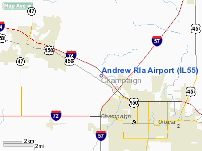
4 nautical miles NW of Champaign, IL |
|
Location: |
Champaign County, IL |
|
Magnetic Variation: |
00W (1985) |
Owner & Manager
|
Ownership: |
Privately owned |
|
Owner: |
F. W. Andrew |
|
Address: |
101 W. Windsor
Urbana, IL 61801 |
|
Phone number: |
217-328-2465 |
|
Address: |
|
Airport Operations and Facilities
|
Airport Use: |
Private |
|
Segmented Circle: |
No |
|
Control Tower: |
No |
|
Landing fee charge: |
No |
|
Sectional chart: |
Chicago |
|
Region: |
AGL - Great Lakes |
|
Boundary ARTCC: |
ZAU - Chicago |
|
Tie-in FSS: |
STL - Saint Louis |
|
FSS on Airport: |
No |
|
FSS Phone: |
636-536-2980 |
|
FSS Toll Free: |
1-800-WX-BRIEF |
Airport Services
|
Airframe
Repair: |
NONE |
|
Power
Plant Repair: |
NONE |
|
Runway
Information
Runway N/S
|
Dimension: |
1200
x 60 ft / 365.8 x 18.3 m |
|
Surface: |
TURF, |
|
|
Runway N |
Runway S |
|
Traffic
Pattern: |
Left |
Left |
|
Radio Navigation
Aids
|
ID |
Type |
Name |
Ch |
Freq |
Var |
Dist |
|
HMJ |
NDB |
Homer |
|
281.00 |
01E |
18.1 nm |
|
PRG |
NDB |
Paris |
|
341.00 |
01E |
40.2 nm |
|
MT |
NDB |
Zebre |
|
347.00 |
00E |
43.6 nm |
|
AAA |
NDB |
Abraham |
|
329.00 |
00E |
47.5 nm |
|
RBS |
VOR/DME |
Roberts |
115X |
116.80 |
02E |
26.1 nm |
|
BMI |
VOR/DME |
Bloomington |
019X |
108.20 |
03E |
34.6 nm |
|
MTO |
VOR/DME |
Mattoon |
031X |
109.40 |
03E |
41.0 nm |
|
PNT |
VOR/DME |
Pontiac |
033X |
109.60 |
03E |
44.3 nm |
|
CMI |
VORTAC |
Champaign |
037X |
110.00 |
03E |
7.7 nm |
|
DNV |
VORTAC |
Danville |
047X |
111.00 |
02E |
35.2 nm |
|
DEC |
VORTAC |
Decatur |
119X |
117.20 |
03E |
36.0 nm |
Based
Aircraft
|
Aircraft
based on field: |
1 |
|
Single
Engine Airplanes: |
1 |
Andrew Rla Airport
Address:
Champaign County, IL
Tel:
217-328-2465
Images
and information placed above are from
http://www.airport-data.com/airport/IL55/
We
thank them for the data!
| General
Info |
| Country |
United
States |
| State |
ILLINOIS
|
| FAA ID |
IL55 |
| Latitude |
40-09-37.116N
|
| Longitude |
088-18-16.188W
|
| Elevation |
810 feet
|
| Near City |
CHAMPAIGN
|
We don't guarantee the information is fresh and accurate. The data may
be wrong or outdated.
For more up-to-date information please refer to other sources.
|
|


