 |
|
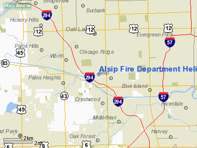
Alsip Fire Department Heliport |
Location
& QuickFacts
|
FAA
Information Effective: |
2007-07-05 |
|
Airport
Identifier: |
IS81 |
|
Airport
Status: |
Operational |
|
Longitude/Latitude: |
087-44-58.1840W/41-40-30.1190N
-87.749496/41.675033 (Estimated) |
|
Elevation: |
623 ft / 189.89 m (Estimated) |
|
Land: |
0 acres |
|
From
nearest city: |
0 nautical miles N of Alsip, IL |
|
Location: |
Cook County, IL |
|
Magnetic Variation: |
01W (1985) |
Owner
& Manager
|
Ownership: |
Publicly
owned |
|
Owner: |
Village Of Alsip |
|
Address: |
12600 S Pulaski Ave
Alsip, IL 60658 |
|
Phone
number: |
708-385-6902 |
|
Manager: |
Ronald Fraider |
|
Address: |
12600 S Pulaski Ave
Alsip, IL 60658 |
|
Phone number: |
708-385-6902 |
Airport Operations and Facilities
|
Airport
Use: |
Private |
|
Wind
indicator: |
Yes |
|
Segmented Circle: |
No |
|
Control
Tower: |
No |
|
Lighting
Schedule: |
PHONE REQ
FOR PERIMETER LGTS CALL 708-385-6902. |
|
Landing
fee charge: |
No |
|
Sectional chart: |
Chicago |
|
Region: |
AGL - Great Lakes |
|
Boundary
ARTCC: |
ZAU - Chicago |
|
Tie-in
FSS: |
IKK - Kankakee |
|
FSS
on Airport: |
No |
|
FSS
Toll Free: |
1-800-WX-BRIEF |
|
Runway Information
Helipad H1
|
Dimension: |
80
x 70 ft / 24.4 x 21.3 m |
|
Surface: |
ASPH, |
|
|
Runway H1 |
Runway |
|
Traffic
Pattern: |
Left |
Left |
|
Markings: |
Basic, |
, |
|
Radio Navigation
Aids
|
ID |
Type |
Name |
Ch |
Freq |
Var |
Dist |
|
HK |
NDB |
Ermin |
|
332.00 |
01W |
4.7 nm |
|
MX |
NDB |
Kedzi |
|
248.00 |
01W |
4.8 nm |
|
ME |
NDB |
Deana |
|
350.00 |
00E |
21.5 nm |
|
VP |
NDB |
Sedly |
|
212.00 |
02W |
41.5 nm |
|
MGC |
NDB |
Michigan City |
|
203.00 |
01W |
41.9 nm |
|
IUL |
NDB |
La Porte |
|
356.00 |
03W |
45.2 nm |
|
DKB |
NDB |
Dekalb |
|
209.00 |
02W |
45.7 nm |
|
ORD |
VOR/DME |
Chicago O'hare |
086X |
113.90 |
02E |
20.0 nm |
|
DPA |
VOR/DME |
Dupage |
021X |
108.40 |
02E |
29.9 nm |
|
OBK |
VOR/DME |
Northbrook |
077X |
113.00 |
02W |
34.1 nm |
|
IKK |
VOR/DME |
Kankakee |
053X |
111.60 |
00E |
36.4 nm |
|
CGT |
VORTAC |
Chicago Heights |
089X |
114.20 |
02E |
12.7 nm |
|
EON |
VORTAC |
Peotone |
079X |
113.20 |
02E |
24.4 nm |
|
JOT |
VORTAC |
Joliet |
070X |
112.30 |
02E |
26.7 nm |
|
MDW |
VOT |
Chicago Midway |
|
111.00 |
|
6.7 nm |
|
ORD |
VOT |
Chicago O'hare Intl |
|
112.00 |
|
19.8 nm |
Remarks
- PRVDD
POLE ON WEST EDGE OF HELIPAD BE REMOVED; INGRESS/EGRESS ROUTES ARE LMTD
TO 180225 & 360 DEGS BEARINGS.
Alsip Fire Department Heliport
Address:
Cook County, IL
Tel:
708-385-6902
Images
and information placed above are from
http://www.airport-data.com/airport/IS81/
We
thank them for the data!
| General
Info |
| Country |
United
States |
| State |
ILLINOIS
|
| FAA ID |
IS81 |
| Latitude |
41-40-30.119N
|
| Longitude |
087-44-58.184W
|
| Elevation |
623 feet
|
| Near City |
ALSIP
|
We don't guarantee the information is fresh and accurate. The data may
be wrong or outdated.
For more up-to-date information please refer to other sources.
|
|


