 |
|
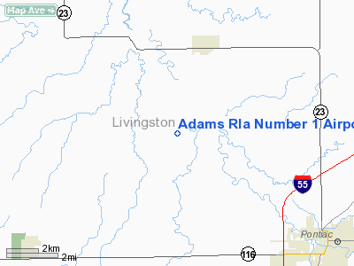
Adams Rla Number 1 Airport |
Location
& QuickFacts
|
FAA
Information Effective: |
2007-07-05 |
|
Airport
Identifier: |
70LL |
|
Airport
Status: |
Operational |
|
Longitude/Latitude: |
088-45-00.2410W/40-56-30.1190N
-88.750067/40.941700 (Estimated) |
|
Elevation: |
640 ft / 195.07 m (Estimated) |
|
Land: |
7 acres |
|
From
nearest city: |
10 nautical miles NW of Pontiac, IL |
|
Location: |
Livingston County, IL |
|
Magnetic Variation: |
00E (1985) |
Owner
& Manager
|
Ownership: |
Privately
owned |
|
Owner: |
James M And Sandra Adams |
|
Address: |
Rr 3
Pontiac, IL 61764 |
|
Phone
number: |
815-844-5647 |
|
Manager: |
James M And Sandra Adams |
|
Address: |
Rr 3 10235 E 2100 N Rd
Pontiac, IL 61764 |
|
Phone number: |
815-844-5647 |
Airport Operations and Facilities
|
Airport
Use: |
Private |
|
Wind
indicator: |
Yes |
|
Segmented Circle: |
No |
|
Control
Tower: |
No |
|
Lighting
Schedule: |
PHONE REQ
FOR LIRL 18/36 CALL 815-844-5647. |
|
Sectional chart: |
Chicago |
|
Region: |
AGL - Great Lakes |
|
Boundary
ARTCC: |
ZAU - Chicago |
|
Tie-in
FSS: |
IKK - Kankakee |
|
FSS
on Airport: |
No |
|
FSS
Toll Free: |
1-800-WX-BRIEF |
|
Runway Information
Runway 18/36
|
Dimension: |
3600
x 80 ft / 1097.3 x 24.4 m |
|
Surface: |
TURF, |
|
Edge
Lights: |
Low |
|
|
Runway 18 |
Runway 36 |
|
Traffic
Pattern: |
Right |
Left |
|
Radio Navigation
Aids
|
ID |
Type |
Name |
Ch |
Freq |
Var |
Dist |
|
OIX |
NDB |
Ottawa |
|
266.00 |
01E |
25.7 nm |
|
VYS |
NDB |
Valley |
|
230.00 |
00W |
30.7 nm |
|
PI |
NDB |
Tungg |
|
356.00 |
01E |
43.4 nm |
|
PNT |
VOR/DME |
Pontiac |
033X |
109.60 |
03E |
7.3 nm |
|
BMI |
VOR/DME |
Bloomington |
019X |
108.20 |
03E |
28.9 nm |
|
RBS |
VOR/DME |
Roberts |
115X |
116.80 |
02E |
34.3 nm |
|
IKK |
VOR/DME |
Kankakee |
053X |
111.60 |
00E |
41.6 nm |
|
BDF |
VORTAC |
Bradford |
094X |
114.70 |
00E |
40.2 nm |
|
JOT |
VORTAC |
Joliet |
070X |
112.30 |
02E |
41.3 nm |
|
EON |
VORTAC |
Peotone |
079X |
113.20 |
02E |
47.7 nm |
|
PIA |
VORTAC |
Peoria |
099X |
115.20 |
04E |
50.0 nm |
Remarks
- PROVIDED
THE TFC PAT OPNS OF THE ARPT ARE CONDUCTED WEST OF THE N/S RWY.
Based
Aircraft
|
Aircraft
based on field: |
1 |
|
Single
Engine Airplanes: |
1 |
Adams Rla Number 1 Airport
Address:
Livingston County, IL
Tel:
815-844-5647
Images
and information placed above are from
http://www.airport-data.com/airport/70LL/
We
thank them for the data!
| General
Info |
| Country |
United
States |
| State |
ILLINOIS
|
| FAA ID |
70LL |
| Latitude |
40-56-30.119N
|
| Longitude |
088-45-00.241W
|
| Elevation |
640 feet
|
| Near City |
PONTIAC
|
We don't guarantee the information is fresh and accurate. The data may
be wrong or outdated.
For more up-to-date information please refer to other sources.
|
|


