 |
|
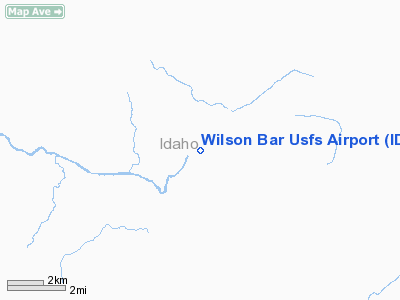
Wilson Bar U.S. Forest Service Airport |
Location
& QuickFacts
|
FAA
Information Effective: |
2007-07-05 |
|
Airport
Identifier: |
ID76 |
|
Airport
Status: |
Operational |
|
Longitude/Latitude: |
115-29-00.0000W/45-23-48.0000N
-115.483333/45.396667 (Estimated) |
|
Elevation: |
2250 ft / 685.80 m (Estimated) |
|
Land: |
0 acres |
|
From
nearest city: |
8 nautical miles S of Dixie, ID |
|
Location: |
Idaho County, ID |
|
Magnetic
Variation: |
17E (1995) |
Owner
& Manager
|
Ownership: |
Publicly
owned |
|
Owner: |
Nez Perce National Forest |
|
Address: |
Route 2 Box 475
Grangeville, ID 83530 |
|
Phone
number: |
208-983-1950 |
|
Manager: |
Salmon River Ranger District |
|
Address: |
Hco1 Box 70
White Bird, ID 83554-9706 |
|
Phone
number: |
208-839-2211 |
Airport
Operations and Facilities
|
Airport
Use: |
Private |
|
Segmented Circle: |
No |
|
Control
Tower: |
No |
|
Sectional chart: |
Great Falls |
|
Region: |
ANM - Northwest Mountain |
|
Boundary
ARTCC: |
ZSE - Seattle |
|
Tie-in
FSS: |
BOI - Boise |
|
FSS
on Airport: |
No |
|
FSS
Phone: |
208-332-0200 |
|
FSS
Toll Free: |
1-800-WX-BRIEF |
|
Runway Information
Runway 06/24
|
Dimension: |
1500
x 50 ft / 457.2 x 15.2 m |
|
Surface: |
TURF, |
|
|
Runway 06 |
Runway 24 |
|
Traffic
Pattern: |
Left |
Left |
|
Obstruction: |
40 ft trees, 30.0 ft from runway |
15 ft trees, 75.0 ft from runway |
|
Radio Navigation
Aids
|
ID |
Type |
Name |
Ch |
Freq |
Var |
Dist |
|
IOM |
NDB |
Mc Call |
|
363.00 |
17E |
44.2 nm |
|
GVV |
NDB |
Grain |
|
280.00 |
18E |
45.0 nm |
|
DNJ |
VORTAC |
Donnelly |
109X |
116.20 |
19E |
48.7 nm |
Remarks
- STRIP
DOWNDRAFTS PREVALENT ON APCH TO RY 24.
- BIG
GAME ANIMALS ON & INVOF ARPT.
- NO
WINTER MAINTENANCE.
- PRVDD
PRIVATE VFR AND BRIEF POTENTIAL USERS ON APRT ENVIRONS.
Wilson Bar U S Forest Service Airport
Address:
Idaho County, ID
Tel:
208-983-1950,
208-839-2211
Images
and information placed above are from
http://www.airport-data.com/airport/ID76/
We
thank them for the data!
| General
Info |
| Country |
United
States |
| State |
IDAHO
|
| FAA ID |
ID76 |
| Latitude |
45-23-48.000N
|
| Longitude |
115-29-00.000W
|
| Elevation |
2250 feet
|
| Near City |
DIXIE
|
We don't guarantee the information is fresh and accurate. The data may
be wrong or outdated.
For more up-to-date information please refer to other sources.
|
|


