 |
|
Coordinates: 43°56′37″N 114°06′37″W / 43.94361°N 114.11028°W / 43.94361; -114.11028
| Twin Bridges Airport |
| IATA: none – ICAO: none – FAA LID: U61 |
| Summary |
| Airport type |
Public |
| Owner |
State of Idaho |
| Operator |
Idaho Transportation Dept., Div. of Aeronautics |
| Serves |
Ketchum, Idaho |
| Elevation AMSL |
6,893 ft / 2,101 m |
| Runways |
| Direction |
Length |
Surface |
| ft |
m |
| 3/21 |
4,450 |
1,356 |
Turf |
| Statistics (2005) |
| Aircraft operations |
800 |
| Source: Federal Aviation Administration |
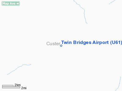
Twin Bridges Airport (FAA LID: U61) is a state-owned public-use airstrip located 22 miles (35 km) northeast of the central business district of Ketchum, a city in Custer County, Idaho, United States.
Facilities and aircraft
Twin Bridges Airport covers an area of 60 acres (24 ha) which contains one runway (3/21) with a turf surface measuring 4,450 x 100 ft (1,356 x 30 m). For the 12-month period ending August 17, 2005, the airport had 800 aircraft operations: 75% general aviation and 25% air taxi. The airport is located close to the Big Lost River in a narrow valley. Approaches to runway 21 must be flown off the extended runway centerline due to a mountain.
The above content comes from Wikipedia and is published under free licenses – click here to read more.
Location
& QuickFacts
|
FAA
Information Effective: |
2007-07-05 |
|
Airport
Identifier: |
U61 |
|
Airport
Status: |
Operational |
|
Longitude/Latitude: |
114-06-35.1700W/43-56-47.6920N
-114.109769/43.946581 (Estimated) |
|
Elevation: |
6893 ft / 2100.99 m (Surveyed) |
|
Land: |
60 acres |
|
From
nearest city: |
22 nautical miles NE of Ketchum, ID |
|
Location: |
Custer County, ID |
|
Magnetic
Variation: |
17E (1985) |
Owner
& Manager
|
Ownership: |
Publicly
owned |
|
Owner: |
State Of Id, Itd Div Of Aero |
|
Address: |
P.o. Box 7129
Boise, ID 83707-1129 |
|
Phone
number: |
208-334-8775 |
|
Manager: |
Div Admin |
|
Address: |
P.o. Box 7129
Boise, ID 83707-1129 |
|
Phone
number: |
208-334-8775 |
Airport
Operations and Facilities
|
Airport
Use: |
Open
to public |
|
Wind
indicator: |
Yes |
|
Segmented Circle: |
Yes |
|
Control
Tower: |
No |
|
Landing
fee charge: |
No |
|
Sectional chart: |
Salt Lake City |
|
Region: |
ANM - Northwest Mountain |
|
Boundary
ARTCC: |
ZLC - Salt Lake City |
|
Tie-in
FSS: |
BOI - Boise |
|
FSS
on Airport: |
No |
|
FSS
Phone: |
208-332-0200 |
|
FSS
Toll Free: |
1-800-WX-BRIEF |
|
NOTAMs
Facility: |
BOI (NOTAM-d service avaliable) |
Airport
Communications
Airport
Services
|
Airframe
Repair: |
NONE |
|
Power
Plant Repair: |
NONE |
|
Bottled
Oxygen: |
NONE |
|
Bulk
Oxygen: |
NONE |
|
Runway Information
Runway 03/21
|
Dimension: |
4450 x 100 ft / 1356.4 x 30.5 m
RY 03/21 SW 560 FT RUTTED AND UNUSABLE. |
|
Surface: |
TURF, Fair Condition |
|
|
Runway 03 |
Runway 21 |
|
Traffic
Pattern: |
Left |
Left |
|
Obstruction: |
2 ft berm, 30L/ ft right of centerline |
430 ft mtn, 1300.0 ft from runway, 200 ft right
of centerline, 3:1 slope to clear |
|
Radio Navigation
Aids
|
ID |
Type |
Name |
Ch |
Freq |
Var |
Dist |
|
LLJ |
NDB |
Challis |
|
397.00 |
17E |
34.7 nm |
|
AOC |
NDB |
Arco |
|
200.00 |
15E |
39.3 nm |
|
HLE |
NDB/DME |
Hailey |
025X |
220.00 |
16E |
37.6 nm |
Remarks
- NO
WINTER MAINT.
- ARPT
LCTD IN HIGH MTN VALLEY SURROUNDED BY HIGH MTNS.
- BE
ALERT ARPT SUBJECT TO ONGOING DAMAGE BY LIVESTOCK; GROUND VEHICLES AND
RODENTS.
- RY
03/21 -1 FT DITCH & +1 FT - 2 FT DIRT BERM ENTIRE PERIMETER OF RY.
- ESTABD
PRIOR TO 3/31/59.
Operational
Statistics
Time Period: 2004-08-18
- 2005-08-17
|
Aircraft
Operations: |
16/Week |
|
Air
Taxi: |
25.0% |
|
General
Aviation Itinerant: |
75.0% |
Twin Bridges Airport
Address:
Custer County, ID
Tel:
208-334-8775
Images
and information placed above are from
http://www.airport-data.com/airport/U61/
We
thank them for the data!
| General
Info |
| Country |
United
States |
| State |
IDAHO
|
| FAA ID |
U61 |
| Latitude |
43-56-47.692N
|
| Longitude |
114-06-35.170W
|
| Elevation |
6893 feet
|
| Near City |
KETCHUM
|
We don't guarantee the information is fresh and accurate. The data may
be wrong or outdated.
For more up-to-date information please refer to other sources.
|
|


