 |
|
|
|
|
|
Location
& QuickFacts
|
FAA
Information Effective: |
2007-07-05 |
|
Airport
Identifier: |
ID40 |
|
Airport
Status: |
Operational |
|
Longitude/Latitude: |
116-42-22.2600W/43-25-04.0800N
-116.706183/43.417800 (Estimated) |
|
Elevation: |
2240 ft / 682.75 m (Estimated) |
|
Land: |
12 acres |
|
From
nearest city: |
9 nautical miles SE of Marsing, ID |
|
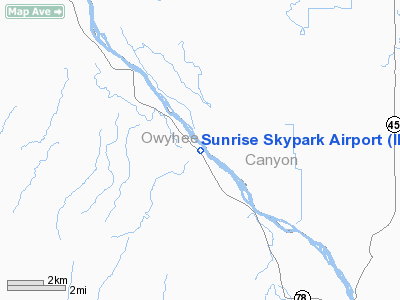
Location: |
Owyhee County, ID |
|
Magnetic
Variation: |
16E (1985) |
Owner
& Manager
|
Ownership: |
Privately
owned |
|
Owner: |
Sunrise Sky Park Homeowners Assn |
|
Address: |
11158 State Hwy 78
Melba, ID 83641 |
|
Phone
number: |
208-495-2120 |
|
Manager: |
Sunrise Sky Park Homeowners Assn |
|
Address: |
11158 State Hwy 78
Melba, ID 83641 |
|
Phone
number: |
208-495-2120 |
Airport
Operations and Facilities
|
Airport
Use: |
Private |
|
Wind
indicator: |
Yes |
|
Segmented Circle: |
Yes
SE END OF RY. |
|
Control
Tower: |
No |
|
Lighting
Schedule: |
PHONE REQ
FOR MIRL RY 12/30 CALL 208-495-2120. |
|
Landing
fee charge: |
No |
|
Sectional chart: |
Salt Lake City |
|
Region: |
ANM - Northwest Mountain |
|
Boundary
ARTCC: |
ZLC - Salt Lake City |
|
Tie-in
FSS: |
BOI - Boise |
|
FSS
on Airport: |
No |
|
FSS
Phone: |
208-332-0200 |
|
FSS
Toll Free: |
1-800-WX-BRIEF |
|
Runway Information
Runway 12/30
|
Dimension: |
2892
x 40 ft / 881.5 x 12.2 m |
|
Surface: |
ASPH, |
|
Edge
Lights: |
Medium |
|
|
Runway 12 |
Runway 30 |
|
Longitude: |
116-42-35.7000W |
116-42-09.0600W |
|
Latitude: |
43-25-14.5800N |
43-24-53.6400N |
|
Alignment: |
127 |
127 |
|
Traffic
Pattern: |
Left |
Left |
|
Displaced
threshold: |
500.00 ft |
500.00 ft |
|
Obstruction: |
4 ft fence, 50.0 ft from runway |
4 ft fence, 50.0 ft from runway |
|
Radio Navigation
Aids
|
ID |
Type |
Name |
Ch |
Freq |
Var |
Dist |
|
MPA |
NDB |
Meridian |
|
238.00 |
16E |
13.3 nm |
|
BO |
NDB |
Ustik |
|
359.00 |
17E |
20.2 nm |
|
ONO |
NDB |
Ontario |
|
305.00 |
17E |
38.5 nm |
|
STI |
NDB |
Sturgeon |
|
333.00 |
17E |
49.4 nm |
|
MUO |
TACAN |
Mountain Home |
087X |
|
18E |
42.9 nm |
|
LIA |
VOR |
Liberator |
|
114.90 |
18E |
48.5 nm |
|
BOI |
VORTAC |
Boise |
080X |
113.30 |
17E |
23.8 nm |
|
BOI |
VOT |
Boise |
|
116.70 |
|
22.7 nm |
Based
Aircraft
|
Aircraft
based on field: |
41 |
|
Single
Engine Airplanes: |
38 |
|
Ultralights: |
3 |
Sunrise Skypark Airport
Address:
Owyhee County, ID
Tel:
208-495-2120
Images
and information placed above are from
http://www.airport-data.com/airport/ID40/
We
thank them for the data!
| General
Info |
| Country |
United
States |
| State |
IDAHO
|
| FAA ID |
ID40 |
| Latitude |
43-25-00.572N
|
| Longitude |
116-42-20.471W
|
| Elevation |
2240 feet
|
| Near City |
MARSING
|
We don't guarantee the information is fresh and accurate. The data may
be wrong or outdated.
For more up-to-date information please refer to other sources.
|
|


