 |
|
|
|
|
|
Location
& QuickFacts
|
FAA
Information Effective: |
2007-07-05 |
|
Airport
Identifier: |
ID49 |
|
Airport
Status: |
Operational |
|
Longitude/Latitude: |
116-11-31.4000W/43-36-45.6000N
-116.192056/43.612667 (Estimated) |
|
Elevation: |
2863 ft / 872.64 m (Surveyed) |
|
Land: |
1 acres |
|
From
nearest city: |
0 nautical miles N of Boise, ID |
|
Location: |
Ada County, ID |
|
Magnetic
Variation: |
17E (1985) |
Owner
& Manager
|
Ownership: |
Privately
owned |
|
Owner: |
St. Luke's Reg. Med. Center |
|
Address: |
190 E. Bannock
Boise, ID 83712 |
|
Phone
number: |
208-386-2222 |
|
Manager: |
Ben Strawn Dir Bldg Services |
|
Address: |
190 E. Bannock
Boise, ID 83712 |
|
Phone
number: |
208-386-2255 |
Airport
Operations and Facilities
|
Airport
Use: |
Private
MEDICAL USE. |
|
Wind
indicator: |
Yes |
|
Segmented Circle: |
No |
|
Control
Tower: |
No |
|
Lighting
Schedule: |
PHONE REQ
FOR PERIMETER LGTS PHONE 208-386-2255. |
|
Landing
fee charge: |
No |
|
Sectional chart: |
Salt Lake City |
|
Region: |
ANM - Northwest Mountain |
|
Boundary
ARTCC: |
ZLC - Salt Lake City |
|
Tie-in
FSS: |
BOI - Boise |
|
FSS
on Airport: |
No |
|
FSS
Phone: |
208-332-0200 |
|
FSS
Toll Free: |
1-800-WX-BRIEF |
|
Runway Information
Helipad H1
|
Dimension: |
90
x 60 ft / 27.4 x 18.3 m |
|
Surface: |
ASPH,
ROOF TOP. |
|
|
Runway H1 |
Runway |
|
Traffic
Pattern: |
Left |
Left |
|
Radio Navigation
Aids
|
ID |
Type |
Name |
Ch |
Freq |
Var |
Dist |
|
BO |
NDB |
Ustik |
|
359.00 |
17E |
5.4 nm |
|
MPA |
NDB |
Meridian |
|
238.00 |
16E |
15.1 nm |
|
STI |
NDB |
Sturgeon |
|
333.00 |
17E |
38.0 nm |
|
ONO |
NDB |
Ontario |
|
305.00 |
17E |
43.0 nm |
|
MUO |
TACAN |
Mountain Home |
087X |
|
18E |
37.1 nm |
|
LIA |
VOR |
Liberator |
|
114.90 |
18E |
42.0 nm |
|
BOI |
VORTAC |
Boise |
080X |
113.30 |
17E |
3.6 nm |
|
BOI |
VOT |
Boise |
|
116.70 |
|
3.0 nm |
Remarks
- PRVD
INGRESS/EGRESS RTES ARE ESTABD IN ACCORD WITH FAR 91.79D.
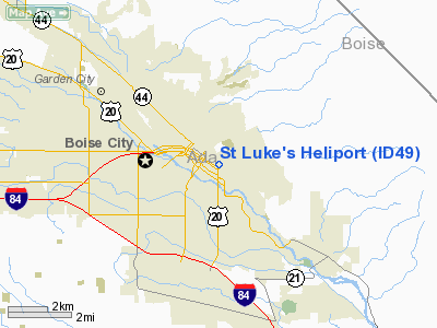
St Luke's Heliport
Address:
Ada County, ID
Tel:
208-386-2222,
208-386-2255
Images
and information placed above are from
http://www.airport-data.com/airport/ID49/
We
thank them for the data!
| General
Info |
| Country |
United
States |
| State |
IDAHO
|
| FAA ID |
ID49 |
| Latitude |
43-36-45.600N
|
| Longitude |
116-11-31.400W
|
| Elevation |
2863 feet
|
| Near City |
BOISE
|
We don't guarantee the information is fresh and accurate. The data may
be wrong or outdated.
For more up-to-date information please refer to other sources.
|
|


