 |
|
Spencer Ranch Landing Strip Airport |
|
|
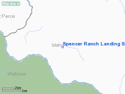
Location
& QuickFacts
|
FAA
Information Effective: |
2007-07-05 |
|
Airport
Identifier: |
ID90 |
|
Airport
Status: |
Operational |
|
Longitude/Latitude: |
116-39-33.5200W/45-50-19.5640N
-116.659311/45.838768 (Estimated) |
|
Elevation: |
4284 ft / 1305.76 m (Estimated) |
|
Land: |
0 acres |
|
From
nearest city: |
15 nautical miles SW of Keuterville, ID |
|
Location: |
Idaho County, ID |
|
Magnetic
Variation: |
18E (1985) |
Owner
& Manager
|
Ownership: |
Privately
owned |
|
Owner: |
Spencer Ranch, Inc. |
|
Address: |
Rt 2, Box 504
Grangeville, ID 83530 |
|
Phone
number: |
208-983-2254 |
|
Manager: |
Craig L. Spencer |
|
Address: |
Rt 2, Box 504
Grangeville, ID 83530 |
|
Phone
number: |
208-983-2254 |
Airport
Operations and Facilities
|
Airport Use: |
Private |
|
Wind
indicator: |
No |
|
Segmented
Circle: |
No |
|
Control
Tower: |
No |
|
Landing
fee charge: |
No |
|
Sectional
chart: |
Great Falls |
|
Region: |
ANM - Northwest Mountain |
|
Boundary
ARTCC: |
ZSE - Seattle |
|
Tie-in
FSS: |
BOI - Boise |
|
FSS
on Airport: |
No |
|
FSS
Phone: |
208-332-0200 |
|
FSS
Toll Free: |
1-800-WX-BRIEF |
Airport
Services
|
Airframe
Repair: |
NONE |
|
Power
Plant Repair: |
NONE |
|
Runway Information
Runway N/S
|
Dimension: |
2000
x 50 ft / 609.6 x 15.2 m |
|
Surface: |
DIRT, |
|
|
Runway N |
Runway S |
|
Traffic
Pattern: |
Left |
Left |
|
Radio Navigation
Aids
|
ID |
Type |
Name |
Ch |
Freq |
Var |
Dist |
|
GVV |
NDB |
Grain |
|
280.00 |
18E |
19.3 nm |
|
MQG |
VOR/DME |
Nez Perce |
019X |
108.20 |
20E |
33.8 nm |
Remarks
- LCTD
HIGH ON PLATEAU APRX 6NM E OF MOUTH OF SALMON RIVER WHERE IT EMPTIES
INTO SNAKE RIVER.
- VERY
MARGINAL FAC FOR OTR THAN SPECIALIZED USES.
- ESTABD
PRIOR TO 12/31/58.
Spencer Ranch Landing Strip Airport
Address:
Idaho County, ID
Tel:
208-983-2254
Images
and information placed above are from
http://www.airport-data.com/airport/ID90/
We
thank them for the data!
| General
Info |
| Country |
United
States |
| State |
IDAHO
|
| FAA ID |
ID90 |
| Latitude |
45-50-19.564N
|
| Longitude |
116-39-33.520W
|
| Elevation |
4284 feet
|
| Near City |
KEUTERVILLE
|
We don't guarantee the information is fresh and accurate. The data may
be wrong or outdated.
For more up-to-date information please refer to other sources.
|
|


