 |
|
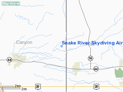
Snake River Skydiving Airport |
Location
& QuickFacts
|
FAA
Information Effective: |
2007-07-05 |
|
Airport
Identifier: |
ID92 |
|
Airport
Status: |
Operational |
|
Longitude/Latitude: |
116-31-22.4730W/43-43-43.5840N
-116.522909/43.728773 (Estimated) |
|
Elevation: |
2550 ft / 777.24 m (Estimated) |
|
Land: |
0 acres |
|
From
nearest city: |
2 nautical miles NW of Star, ID |
|
Location: |
Canyon County, ID |
|
Magnetic
Variation: |
17E (1985) |
Owner
& Manager
|
Ownership: |
Privately
owned |
|
Owner: |
Thomas Foster |
|
Address: |
4005 N. Canada Road
Star, ID 83668 |
|
Phone
number: |
208-286-7912 |
|
Manager: |
Boise Valley Skydivers |
|
Address: |
P.o. Box 3383
Boise, ID 83703 |
Airport
Operations and Facilities
|
Airport
Use: |
Private |
|
Wind
indicator: |
Yes |
|
Segmented Circle: |
No |
|
Control
Tower: |
No |
|
Landing
fee charge: |
No |
|
Sectional chart: |
Klamath Falls |
|
Region: |
ANM - Northwest Mountain |
|
Boundary
ARTCC: |
ZLC - Salt Lake City |
|
Tie-in
FSS: |
BOI - Boise |
|
FSS
on Airport: |
No |
|
FSS
Phone: |
208-332-0200 |
|
FSS
Toll Free: |
1-800-WX-BRIEF |
|
Runway Information
Runway 05/23
|
Dimension: |
4200
x 60 ft / 1280.2 x 18.3 m |
|
Surface: |
ASPH, |
|
|
Runway 05 |
Runway 23 |
|
Traffic
Pattern: |
Left |
Right |
|
Radio Navigation
Aids
|
ID |
Type |
Name |
Ch |
Freq |
Var |
Dist |
|
MPA |
NDB |
Meridian |
|
238.00 |
16E |
7.6 nm |
|
BO |
NDB |
Ustik |
|
359.00 |
17E |
12.0 nm |
|
ONO |
NDB |
Ontario |
|
305.00 |
17E |
27.4 nm |
|
BOI |
VORTAC |
Boise |
080X |
113.30 |
17E |
17.9 nm |
|
BOI |
VOT |
Boise |
|
116.70 |
|
15.9 nm |
Remarks
- PRVDD
TFC PATS ARE FLOWN ON N SIDE OF ARPT.
Based
Aircraft
|
Aircraft
based on field: |
4 |
|
Single
Engine Airplanes: |
3 |
|
Multi
Engine Airplanes: |
1 |
Snake River Skydiving Airport
Address:
Canyon County, ID
Tel:
208-286-7912
Images
and information placed above are from
http://www.airport-data.com/airport/ID92/
We
thank them for the data!
| General
Info |
| Country |
United
States |
| State |
IDAHO
|
| FAA ID |
ID92 |
| Latitude |
43-43-43.584N
|
| Longitude |
116-31-22.473W
|
| Elevation |
2550 feet
|
| Near City |
STAR |
We don't guarantee the information is fresh and accurate. The data may
be wrong or outdated.
For more up-to-date information please refer to other sources.
|
|


