 |
|
|
|
|
|
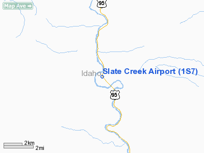
Location
& QuickFacts
|
FAA
Information Effective: |
2007-07-05 |
|
Airport
Identifier: |
1S7 |
|
Airport
Status: |
Operational |
|
Longitude/Latitude: |
116-18-33.5020W/45-40-29.5880N
-116.309306/45.674886 (Estimated) |
|
Elevation: |
1660 ft / 505.97 m (Estimated) |
|
Land: |
13 acres |
|
From
nearest city: |
3 nautical miles NW of Slate Creek, ID |
|
Location: |
Idaho County, ID |
|
Magnetic
Variation: |
18E (1985) |
Owner
& Manager
|
Ownership: |
Publicly
owned |
|
Owner: |
State Of Id Itd, Div Aero |
|
Address: |
Po Box 7129
Boise, ID 83707-1129 |
|
Phone
number: |
208-334-8775 |
|
Manager: |
Division Admin. |
|
Address: |
Po Box 7129
Boise, ID 83707-1129 |
|
Phone
number: |
208-334-8775 |
Airport
Operations and Facilities
|
Airport
Use: |
Open
to public |
|
Wind
indicator: |
Yes |
|
Segmented Circle: |
Yes |
|
Control
Tower: |
No |
|
Landing
fee charge: |
No |
|
Sectional chart: |
Great Falls |
|
Region: |
ANM - Northwest Mountain |
|
Boundary
ARTCC: |
ZSE - Seattle |
|
Tie-in
FSS: |
BOI - Boise |
|
FSS
on Airport: |
No |
|
FSS
Phone: |
208-332-0200 |
|
FSS
Toll Free: |
1-800-WX-BRIEF |
|
NOTAMs
Facility: |
BOI (NOTAM-d service avaliable) |
Airport
Communications
Airport
Services
|
Airframe
Repair: |
NONE |
|
Power
Plant Repair: |
NONE |
|
Bottled
Oxygen: |
NONE |
|
Bulk
Oxygen: |
NONE |
|
Runway Information
Runway 11/29
|
Dimension: |
2600
x 165 ft / 792.5 x 50.3 m |
|
Surface: |
TURF, Good Condition |
|
|
Runway 11 |
Runway 29 |
|
Traffic
Pattern: |
Left |
Left |
|
Obstruction: |
4 ft fence, 90 ft left of centerline
RY 11 HAS +3 FT FENCES AT 30 FT AND 35 FT ON CTRLN. |
30 ft pline, 0.0 ft from runway, 100 ft right
of centerline |
|
Radio Navigation
Aids
|
ID |
Type |
Name |
Ch |
Freq |
Var |
Dist |
|
GVV |
NDB |
Grain |
|
280.00 |
18E |
16.3 nm |
|
MQG |
VOR/DME |
Nez Perce |
019X |
108.20 |
20E |
48.5 nm |
Remarks
- NO
LINE OF SIGHT BETWEEN RWY ENDS.
- +35'
PLINE ALONG NE BNDRY OF ARPT, CROSSES OVER TIEDOWN AREA.
- RWY
11/29 YELLOW & BLACK WARNING PANELS INSTALLED ON FENCE ON BOTH RWY
THRS.
- NO
WINTER MAINT.
- NO
TELEPHONE AVBL AT ARPT.
- RY
11 HAS ADDL OBSTN +35 FT POLE & GUY WIRE AT 10 FT 100 FT L MARKED.
- ESTABD
PRIOR TO 12/31/58.
Operational
Statistics
Time Period: 2005-05-12
- 2006-05-11
|
Aircraft
Operations: |
43/Week |
|
Air
Taxi: |
9.1% |
|
General
Aviation Itinerant: |
90.9% |
Slate Creek Airport
Address:
Idaho County, ID
Tel:
208-334-8775
Images
and information placed above are from
http://www.airport-data.com/airport/1S7/
We
thank them for the data!
| General
Info |
| Country |
United
States |
| State |
IDAHO
|
| FAA ID |
1S7 |
| Latitude |
45-40-29.588N
|
| Longitude |
116-18-33.502W
|
| Elevation |
1660 feet
|
| Near City |
SLATE
CREEK |
We don't guarantee the information is fresh and accurate. The data may
be wrong or outdated.
For more up-to-date information please refer to other sources.
|
|


