 |
|
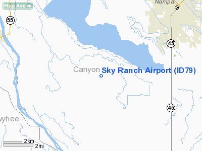
Location
& QuickFacts
|
FAA
Information Effective: |
2007-07-05 |
|
Airport
Identifier: |
ID79 |
|
Airport
Status: |
Operational |
|
Longitude/Latitude: |
116-40-04.5000W/43-30-30.0000N
-116.667917/43.508333 (Estimated) |
|
Elevation: |
2750 ft / 838.20 m (Estimated) |
|
Land: |
80 acres |
|
From
nearest city: |
8 nautical miles SE of Nampa, ID |
|
Location: |
Canyon County, ID |
|
Magnetic
Variation: |
17E (1995) |
Owner
& Manager
|
Ownership: |
Privately
owned |
|
Owner: |
Frank Amen |
|
Address: |
9125 Sky Ranch Road
Nampa, ID 83636 |
|
Phone
number: |
208-466-1853 |
|
Manager: |
Frank Amen |
|
Address: |
9125 Sky Ranch Road
Nampa, ID 83636 |
|
Phone
number: |
208-466-1853 |
Airport
Operations and Facilities
|
Airport
Use: |
Private |
|
Segmented Circle: |
No |
|
Control
Tower: |
No |
|
Sectional chart: |
Salt Lake City |
|
Region: |
ANM - Northwest Mountain |
|
Boundary
ARTCC: |
ZLC - Salt Lake City |
|
Tie-in
FSS: |
BOI - Boise |
|
FSS
Phone: |
208-332-0200 |
|
FSS
Toll Free: |
1-800-WX-BRIEF |
|
Runway Information
Runway 09/27
|
Dimension: |
2200
x 35 ft / 670.6 x 10.7 m |
|
Surface: |
DIRT, |
|
|
Runway 09 |
Runway 27 |
|
Traffic
Pattern: |
Left |
Left |
|
Obstruction: |
25 ft brush, 1320.0 ft from runway |
|
|
Radio Navigation
Aids
|
ID |
Type |
Name |
Ch |
Freq |
Var |
Dist |
|
MPA |
NDB |
Meridian |
|
238.00 |
16E |
8.0 nm |
|
BO |
NDB |
Ustik |
|
359.00 |
17E |
16.3 nm |
|
ONO |
NDB |
Ontario |
|
305.00 |
17E |
34.1 nm |
|
MUO |
TACAN |
Mountain Home |
087X |
|
18E |
44.7 nm |
|
BOI |
VORTAC |
Boise |
080X |
113.30 |
17E |
20.9 nm |
|
BOI |
VOT |
Boise |
|
116.70 |
|
19.4 nm |
Remarks
Based
Aircraft
|
Aircraft
based on field: |
2 |
|
Single
Engine Airplanes: |
1 |
|
Multi
Engine Airplanes: |
1 |
Sky Ranch Airport
Address:
Canyon County, ID
Tel:
208-466-1853
Images
and information placed above are from
http://www.airport-data.com/airport/ID79/
We
thank them for the data!
| General
Info |
| Country |
United
States |
| State |
IDAHO
|
| FAA ID |
ID79 |
| Latitude |
43-30-30.000N
|
| Longitude |
116-40-04.500W
|
| Elevation |
2750 feet
|
| Near City |
NAMPA
|
We don't guarantee the information is fresh and accurate. The data may
be wrong or outdated.
For more up-to-date information please refer to other sources.
|
|


