 |
|
|
|
|
|
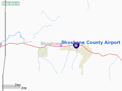
Location
& QuickFacts
|
FAA
Information Effective: |
2007-07-05 |
|
Airport
Identifier: |
S83 |
|
Airport
Status: |
Operational |
|
Longitude/Latitude: |
116-11-18.6030W/47-32-51.7160N
-116.188501/47.547699 (Estimated) |
|
Elevation: |
2223 ft / 677.57 m (Surveyed) |
|
Land: |
75 acres |
|
From
nearest city: |
3 nautical miles W of Kellogg, ID |
|
Location: |
Shoshone County, ID |
|
Magnetic
Variation: |
19E (1985) |
Owner
& Manager
|
Ownership: |
Publicly
owned |
|
Owner: |
Shoshone County |
|
Address: |
700 Bank Street
Wallace, ID 83873-2348 |
|
Phone
number: |
208-752-3331 |
|
Manager: |
Ken Beckedahl |
|
Address: |
926 Airport Rd
Smelterville, ID 83868 |
|
Phone
number: |
208-786-5381 |
Airport
Operations and Facilities
|
Airport
Use: |
Open
to public |
|
Wind
indicator: |
Yes |
|
Segmented Circle: |
Yes |
|
Control
Tower: |
No |
|
Lighting
Schedule: |
PHONE REQ
FOR MIRL RY 07/25 CALL 208-786-5381 OR REQUEST ON UNICOM. |
|
Landing
fee charge: |
No |
|
Sectional chart: |
Great Falls |
|
Region: |
ANM - Northwest Mountain |
|
Traffic
Pattern Alt: |
1000 ft |
|
Boundary
ARTCC: |
ZSE - Seattle |
|
Tie-in
FSS: |
BOI - Boise |
|
FSS
on Airport: |
No |
|
FSS
Phone: |
208-332-0200 |
|
FSS
Toll Free: |
1-800-WX-BRIEF |
|
NOTAMs
Facility: |
BOI (NOTAM-d service avaliable) |
|
Federal
Agreements: |
NGSY |
Airport
Communications
|
CTAF: |
122.800 |
|
Unicom: |
122.800
|
Airport
Services
|
Airframe
Repair: |
MAJOR |
|
Power
Plant Repair: |
MINOR |
|
Bottled
Oxygen: |
NONE |
|
Bulk
Oxygen: |
NONE |
|
Runway Information
Runway 07/25
|
Dimension: |
5500
x 75 ft / 1676.4 x 22.9 m |
|
Surface: |
ASPH, Good Condition |
|
Weight
Limit: |
Single wheel: 14000 lbs. |
|
Edge
Lights: |
Non-standard lighting system
NSTD MIRL; FIRST 1000 FT DSPLCD THLD OF RY 25 UNLIGHTED. |
|
|
Runway 07 |
Runway 25 |
|
Traffic
Pattern: |
Right |
Left |
|
Markings: |
Non-precision instrument, Good Condition |
Basic, Good Condition |
|
Displaced
threshold: |
0.00 ft |
1000.00 ft |
|
Obstruction: |
150 ft ridge, 2500.0 ft from runway, 300 ft
left of centerline, 15:1 slope to clear |
5 ft gnd, 200.0 ft from runway
+80 FT TREES AT 1700 FT ON CNTRLN; 21:1 BASED ON DSPLCD THLD. |
|
Radio Navigation
Aids
|
ID |
Type |
Name |
Ch |
Freq |
Var |
Dist |
|
SFF |
NDB |
Felts |
|
365.00 |
19E |
46.3 nm |
|
SZT |
NDB |
Sandpoe |
|
264.00 |
20E |
47.1 nm |
|
MLP |
VOR/DME |
Mullan Pass |
125X |
117.80 |
20E |
22.7 nm |
|
COE |
VOR/DME |
Coeur D'alene |
025X |
108.80 |
19E |
29.0 nm |
|
SFF |
VOT |
Spokane/felts Field |
|
114.00 |
|
46.5 nm |
Based Aircraft
|
Aircraft
based on field: |
12 |
|
Single
Engine Airplanes: |
12 |
Operational Statistics
Time Period: 2005-06-07
- 2006-06-06
|
Aircraft
Operations: |
145/Week |
|
Air
Taxi: |
10.0% |
|
General
Aviation Local: |
16.0% |
|
General
Aviation Itinerant: |
73.3% |
|
Military: |
0.7% |
Shoshone County Airport
Address:
Shoshone County, ID
Tel:
208-752-3331,
208-786-5381
Images
and information placed above are from
http://www.airport-data.com/airport/S83/
We
thank them for the data!
| General
Info |
| Country |
United
States |
| State |
IDAHO
|
| FAA ID |
S83 |
| Latitude |
47-32-51.716N
|
| Longitude |
116-11-18.603W
|
| Elevation |
2223 feet
|
| Near City |
KELLOGG
|
We don't guarantee the information is fresh and accurate. The data may
be wrong or outdated.
For more up-to-date information please refer to other sources.
|
|


