 |
|
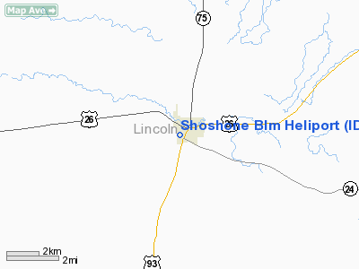
Shoshone Bureau Of Land Management Heliport |
|
|
Location
& QuickFacts
|
FAA
Information Effective: |
2007-07-05 |
|
Airport
Identifier: |
ID42 |
|
Airport
Status: |
Operational |
|
Longitude/Latitude: |
114-24-47.1500W/42-55-54.6590N
-114.413097/42.931850 (Estimated) |
|
Elevation: |
3980 ft / 1213.10 m (Estimated) |
|
Land: |
1 acres |
|
From
nearest city: |
1 nautical miles SW of Shoshone, ID |
|
Location: |
Lincoln County, ID |
|
Magnetic
Variation: |
16E (1985) |
Owner
& Manager
|
Ownership: |
Publicly
owned |
|
Owner: |
Bureau Of Land Management |
|
Address: |
Po Box 2b
Shoshone, ID 83352 |
|
Phone
number: |
208-886-2373 |
|
Manager: |
Blm Fire Management Off |
|
Address: |
Po Box 2b
Shoshone, ID 83352 |
|
Phone
number: |
208-886-2373 |
Airport
Operations and Facilities
|
Airport
Use: |
Private |
|
Wind
indicator: |
Yes |
|
Segmented Circle: |
No |
|
Control
Tower: |
No |
|
Lighting
Schedule: |
RDO-CTL
FOR PERIMETER LGTS KEY 123.05 5 TIMES; 7 TIMES FOR OFF. |
|
Landing
fee charge: |
No |
|
Sectional chart: |
Salt Lake City |
|
Region: |
ANM - Northwest Mountain |
|
Boundary
ARTCC: |
ZLC - Salt Lake City |
|
Tie-in
FSS: |
BOI - Boise |
|
FSS
on Airport: |
No |
|
FSS
Phone: |
208-332-0200 |
|
FSS
Toll Free: |
1-800-WX-BRIEF |
|
Runway Information
Helipad H1
|
Dimension: |
20
x 20 ft / 6.1 x 6.1 m |
|
Surface: |
CONC, Good Condition |
|
|
Runway H1 |
Runway |
|
Traffic
Pattern: |
Left |
Left |
|
Radio Navigation
Aids
|
ID |
Type |
Name |
Ch |
Freq |
Var |
Dist |
|
HDG |
NDB |
Steelhead |
|
211.00 |
16E |
11.5 nm |
|
HLE |
NDB/DME |
Hailey |
025X |
220.00 |
16E |
25.0 nm |
|
BYI |
VOR/DME |
Burley |
088X |
114.10 |
18E |
32.1 nm |
|
TWF |
VORTAC |
Twin Falls |
105X |
115.80 |
18E |
27.4 nm |
Based
Aircraft
|
Aircraft
based on field: |
1 |
|
Helicopters: |
1 |
Shoshone Bureau Of Land Management
Heliport
Address:
Lincoln County, ID
Tel:
208-886-2373
Images
and information placed above are from
http://www.airport-data.com/airport/ID42/
We
thank them for the data!
| General
Info |
| Country |
United
States |
| State |
IDAHO
|
| FAA ID |
ID42 |
| Latitude |
42-55-54.659N
|
| Longitude |
114-24-47.150W
|
| Elevation |
3980 feet
|
| Near City |
SHOSHONE
|
We don't guarantee the information is fresh and accurate. The data may
be wrong or outdated.
For more up-to-date information please refer to other sources.
|
|


