 |
|
Location
& QuickFacts
|
FAA
Information Effective: |
2007-07-05 |
|
Airport
Identifier: |
ID98 |
|
Airport
Status: |
Operational |
|
Longitude/Latitude: |
117-29-42.1900W/42-34-02.6700N
-117.495053/42.567408 (Estimated) |
|
Elevation: |
2000 ft / 609.60 m (Estimated) |
|
Land: |
40 acres |
|
From
nearest city: |
10 nautical miles NE of Coeur D'alene, ID |
|
Location: |
Kootenai County, ID |
|
Magnetic
Variation: |
16E (1995) |
Owner
& Manager
|
Ownership: |
Privately
owned |
|
Owner: |
John T Scanlon |
|
Address: |
6995 West River View Dr
Post Falls, ID 83854 |
|
Phone
number: |
208-773-1111 |
|
Manager: |
John T Scanlon |
|
Address: |
6995 West River View Dr
Post Falls, ID 83854 |
|
Phone
number: |
208-773-1111 |
Airport
Operations and Facilities
|
Airport
Use: |
Private |
|
Wind
indicator: |
Yes |
|
Segmented Circle: |
No |
|
Control
Tower: |
No |
|
Sectional chart: |
Salt Lake City |
|
Region: |
ANM - Northwest Mountain |
|
Boundary
ARTCC: |
ZSE - Seattle |
|
Tie-in
FSS: |
BOI - Boise |
|
FSS
Phone: |
208-332-0200 |
|
FSS
Toll Free: |
1-800-WX-BRIEF |
|
Runway Information
Helipad H1
|
Dimension: |
20
x 20 ft / 6.1 x 6.1 m |
|
Surface: |
CONC, |
|
|
Runway H1 |
Runway |
|
Traffic
Pattern: |
Left |
Left |
|
Radio Navigation
Aids
|
ID |
Type |
Name |
Ch |
Freq |
Var |
Dist |
|
RMD |
NDB |
Mc Dermitt State |
|
204.00 |
17E |
34.9 nm |
|
REO |
VORTAC |
Rome |
072X |
112.50 |
19E |
16.6 nm |
Based Aircraft
|
Aircraft
based on field: |
4 |
|
Helicopters: |
4 |
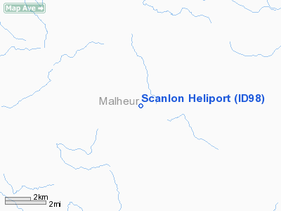
Scanlon Heliport
Address:
Kootenai County, ID
Tel:
208-773-1111
Images
and information placed above are from
http://www.airport-data.com/airport/ID98/
We
thank them for the data!
| General
Info |
| Country |
United
States |
| State |
IDAHO
|
| FAA ID |
ID98 |
| Latitude |
42-34-02.670N
|
| Longitude |
117-29-42.190W
|
| Elevation |
2000 feet
|
| Near City |
COEUR
D'ALENE |
We don't guarantee the information is fresh and accurate. The data may
be wrong or outdated.
For more up-to-date information please refer to other sources.
|
|


