 |
|
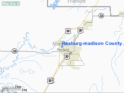
Rexburg - Madison County Airport |
|
|
Location
& QuickFacts
|
FAA
Information Effective: |
2007-07-05 |
|
Airport
Identifier: |
RXE |
|
Airport
Status: |
Operational |
|
Longitude/Latitude: |
111-48-18.3780W/43-50-02.0810N
-111.805105/43.833911 (Estimated) |
|
Elevation: |
4858 ft / 1480.72 m (Surveyed) |
|
Land: |
144 acres |
|
From
nearest city: |
1 nautical miles NW of Rexburg, ID |
|
Location: |
Madison County, ID |
|
Magnetic
Variation: |
15E (1990) |
Owner
& Manager
|
Ownership: |
Publicly
owned |
|
Owner: |
City Of Rexburg & Madison Co |
|
Address: |
P.o. Box 280
Rexburg, ID 83440 |
|
Phone
number: |
208-359-3020 |
|
Manager: |
Warren Smith |
|
Address: |
Po Box 825
Rexburg, ID 83440 |
|
Phone
number: |
208-356-6600 |
Airport
Operations and Facilities
|
Airport
Use: |
Open
to public |
|
Wind
indicator: |
Yes |
|
Segmented Circle: |
Yes |
|
Control
Tower: |
No |
|
Lighting
Schedule: |
DUSK-DAWN
ACTVT VASI RYS 17 & 35, & REIL RY 35 - CTAF. |
|
Beacon
Color: |
Clear-Green (lighted land airport) |
|
Landing
fee charge: |
No |
|
Sectional chart: |
Salt Lake City |
|
Region: |
ANM - Northwest Mountain |
|
Boundary
ARTCC: |
ZLC - Salt Lake City |
|
Tie-in
FSS: |
BOI - Boise |
|
FSS
on Airport: |
No |
|
FSS
Phone: |
208-332-0200 |
|
FSS
Toll Free: |
1-800-WX-BRIEF |
|
NOTAMs
Facility: |
RXE (NOTAM-d service avaliable) |
|
Federal
Agreements: |
NGY |
Airport
Communications
|
CTAF: |
122.800 |
|
Unicom: |
122.800
|
Airport
Services
|
Fuel
available: |
100LLA |
|
Airframe
Repair: |
MAJOR |
|
Power
Plant Repair: |
MAJOR |
|
Bottled
Oxygen: |
HIGH |
|
Bulk
Oxygen: |
NONE |
|
Runway Information
Runway 17/35
|
Dimension: |
4200
x 75 ft / 1280.2 x 22.9 m |
|
Surface: |
ASPH, Good Condition |
|
Weight
Limit: |
Single wheel: 30000 lbs. |
|
Edge
Lights: |
Medium |
|
|
Runway 17 |
Runway 35 |
|
Longitude: |
111-48-15.1670W |
111-48-21.6180W |
|
Latitude: |
43-50-22.7250N |
43-49-41.4890N |
|
Elevation: |
4853.00 ft |
4854.00 ft |
|
Alignment: |
127 |
6 |
|
Traffic
Pattern: |
Left |
Left |
|
Markings: |
Basic, Fair Condition |
Basic, Fair Condition |
|
Crossing
Height: |
50.00 ft |
40.00 ft |
|
Displaced
threshold: |
300.00 ft |
0.00 ft |
|
VASI: |
4-box on right side |
4-box on left side |
|
Visual
Glide Angle: |
3.00° |
3.00° |
|
Runway
End Identifier: |
|
Yes |
|
Obstruction: |
35 ft tree, 600.0 ft from runway, 60 ft right
of centerline, 12:1 slope to clear
RWY 17 APCH SLOPE 26:1 TO DSPLCD THLD.
+10 TO 50 FT TREES AT 160 FT; 150 FT L &
R. |
30 ft trees, 720.0 ft from runway, 18:1 slope
to clear |
|
Decleard
distances: |
Take off run available 4200.00 ft
Take off distance available 4200.00 ft
Actual stop distance available 4200.00 ft
Landing distance available 3900.00 ft |
Take off run available 4200.00 ft
Take off distance available 4200.00 ft
Actual stop distance available 3900.00 ft
Landing distance available 3900.00 ft |
|
Radio Navigation
Aids
|
ID |
Type |
Name |
Ch |
Freq |
Var |
Dist |
|
JAC |
FAN MARKER |
Teton |
|
|
17E |
48.3 nm |
|
SWU |
NDB |
Sweden |
|
350.00 |
15E |
28.7 nm |
|
IDA |
VOR/DME |
Idaho Falls |
85Y |
113.85 |
15E |
22.0 nm |
|
JAC |
VOR/DME |
Jackson |
101X |
115.40 |
13E |
48.3 nm |
|
DBS |
VORTAC |
Dubois |
116X |
116.90 |
15E |
23.3 nm |
Remarks
- ESTABD
PRIOR TO 15 MAY 1959.
Based
Aircraft
|
Aircraft
based on field: |
76 |
|
Single
Engine Airplanes: |
70 |
|
Multi
Engine Airplanes: |
1 |
|
Helicopters: |
2 |
|
Ultralights: |
3 |
Operational Statistics
Time Period: 2005-09-22
- 2006-09-21
|
Aircraft
Operations: |
86/Day |
|
Air
Taxi: |
1.9% |
|
General
Aviation Local: |
59.3% |
|
General
Aviation Itinerant: |
38.5% |
|
Military: |
0.3% |
Rexburg-madison County Airport
Address:
Madison County, ID
Tel:
208-359-3020,
208-356-6600
Images
and information placed above are from
http://www.airport-data.com/airport/RXE/
We
thank them for the data!
| General
Info |
| Country |
United
States |
| State |
IDAHO
|
| FAA ID |
RXE |
| Latitude |
43-50-02.081N
|
| Longitude |
111-48-18.378W
|
| Elevation |
4858 feet
|
| Near City |
REXBURG
|
We don't guarantee the information is fresh and accurate. The data may
be wrong or outdated.
For more up-to-date information please refer to other sources.
|
|


