 |
|
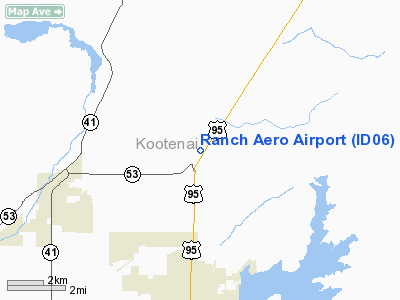
Location
& QuickFacts
|
FAA
Information Effective: |
2007-07-05 |
|
Airport
Identifier: |
ID06 |
|
Airport
Status: |
Operational |
|
Longitude/Latitude: |
116-47-00.6980W/47-49-43.6570N
-116.783527/47.828794 (Estimated) |
|
Elevation: |
2315 ft / 705.61 m (Estimated) |
|
Land: |
0 acres |
|
From
nearest city: |
4 nautical miles N of Hayden Lake, ID |
|
Location: |
Kootenai County, ID |
|
Magnetic
Variation: |
19E (1985) |
Owner
& Manager
|
Ownership: |
Privately
owned |
|
Owner: |
Carl Nyberg |
|
Address: |
Rt 1, Box 853
Pullman, WA 99163 |
|
Phone
number: |
509-332-6667 |
|
Address: |
|
Airport
Operations and Facilities
|
Airport Use: |
Private |
|
Wind
indicator: |
No |
|
Segmented
Circle: |
No |
|
Control
Tower: |
No |
|
Landing
fee charge: |
No |
|
Sectional
chart: |
Great Falls |
|
Region: |
ANM - Northwest Mountain |
|
Boundary
ARTCC: |
ZSE - Seattle |
|
Tie-in
FSS: |
BOI - Boise |
|
FSS
on Airport: |
No |
|
FSS
Phone: |
208-332-0200 |
|
FSS
Toll Free: |
1-800-WX-BRIEF |
Airport
Services
|
Airframe
Repair: |
NONE |
|
Power
Plant Repair: |
NONE |
|
Runway Information
Runway 01/19
|
Dimension: |
2400
x 75 ft / 731.5 x 22.9 m |
|
Surface: |
TURF, |
|
|
Runway 01 |
Runway 19 |
|
Traffic
Pattern: |
Left |
Left |
|
Radio Navigation
Aids
|
ID |
Type |
Name |
Ch |
Freq |
Var |
Dist |
|
SFF |
NDB |
Felts |
|
365.00 |
19E |
23.0 nm |
|
DPY |
NDB |
Deer Park |
|
216.00 |
19E |
27.2 nm |
|
SZT |
NDB |
Sandpoe |
|
264.00 |
20E |
29.1 nm |
|
SKA |
TACAN |
Fairchild |
051X |
|
19E |
37.9 nm |
|
COE |
VOR/DME |
Coeur D'alene |
025X |
108.80 |
19E |
3.6 nm |
|
GEG |
VORTAC |
Spokane |
102X |
115.50 |
21E |
37.6 nm |
|
SFF |
VOT |
Spokane/felts Field |
|
114.00 |
|
23.4 nm |
|
GEG |
VOT |
Spokane Intl |
|
109.60 |
|
33.0 nm |
Remarks
- RUNWAY
NOT MAINTAINED--POOR CONDITION.
Ranch Aero Airport
Address:
Kootenai County, ID
Tel:
509-332-6667
Images
and information placed above are from
http://www.airport-data.com/airport/ID06/
We
thank them for the data!
| General
Info |
| Country |
United
States |
| State |
IDAHO
|
| FAA ID |
ID06 |
| Latitude |
47-49-43.657N
|
| Longitude |
116-47-00.698W
|
| Elevation |
2315 feet
|
| Near City |
HAYDEN
LAKE |
We don't guarantee the information is fresh and accurate. The data may
be wrong or outdated.
For more up-to-date information please refer to other sources.
|
|


