 |
|
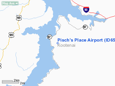
Location
& QuickFacts
|
FAA
Information Effective: |
2007-07-05 |
|
Airport
Identifier: |
ID65 |
|
Airport
Status: |
Operational |
|
Longitude/Latitude: |
116-46-18.6620W/47-34-51.6610N
-116.771851/47.581017 (Estimated) |
|
Elevation: |
2775 ft / 845.82 m (Estimated) |
|
Land: |
0 acres |
|
From
nearest city: |
14 nautical miles S of Coeur D'alene, ID |
|
Location: |
Kootenai County, ID |
|
Magnetic
Variation: |
18E (1990) |
Owner
& Manager
|
Ownership: |
Privately
owned |
|
Owner: |
Don Dean Pischner |
|
Address: |
P.o. Box 7
Coeur D'alene, ID 83814 |
|
Phone
number: |
208-667-5770 |
|
Manager: |
Don Dean Pischner |
|
Address: |
P.o. Box 7
Coeur D'alene, ID 83814 |
|
Phone
number: |
208-667-5770 |
Airport
Operations and Facilities
|
Airport
Use: |
Private |
|
Segmented Circle: |
No |
|
Control
Tower: |
No |
|
Sectional chart: |
Great Falls |
|
Region: |
ANM - Northwest Mountain |
|
Boundary
ARTCC: |
ZSE - Seattle |
|
Tie-in
FSS: |
BOI - Boise |
|
FSS
on Airport: |
No |
|
FSS
Phone: |
208-332-0200 |
|
FSS
Toll Free: |
1-800-WX-BRIEF |
|
Runway Information
Runway 07/25
|
Dimension: |
1900
x 55 ft / 579.1 x 16.8 m |
|
Surface: |
TURF, |
|
|
Runway 07 |
Runway 25 |
|
Traffic
Pattern: |
Left |
Left |
|
Obstruction: |
30 ft trees, 80.0 ft from runway |
|
|
Radio Navigation
Aids
|
ID |
Type |
Name |
Ch |
Freq |
Var |
Dist |
|
SFF |
NDB |
Felts |
|
365.00 |
19E |
22.8 nm |
|
DPY |
NDB |
Deer Park |
|
216.00 |
19E |
35.2 nm |
|
SZT |
NDB |
Sandpoe |
|
264.00 |
20E |
43.5 nm |
|
SKA |
TACAN |
Fairchild |
051X |
|
19E |
36.1 nm |
|
COE |
VOR/DME |
Coeur D'alene |
025X |
108.80 |
19E |
11.7 nm |
|
MLP |
VOR/DME |
Mullan Pass |
125X |
117.80 |
20E |
46.3 nm |
|
GEG |
VORTAC |
Spokane |
102X |
115.50 |
21E |
34.7 nm |
|
SFF |
VOT |
Spokane/felts Field |
|
114.00 |
|
23.0 nm |
|
GEG |
VOT |
Spokane Intl |
|
109.60 |
|
31.3 nm |
Based
Aircraft
|
Aircraft
based on field: |
1 |
|
Single
Engine Airplanes: |
1 |
Pisch's Place Airport
Address:
Kootenai County, ID
Tel:
208-667-5770
Images
and information placed above are from
http://www.airport-data.com/airport/ID65/
We
thank them for the data!
| General
Info |
| Country |
United
States |
| State |
IDAHO
|
| FAA ID |
ID65 |
| Latitude |
47-34-51.661N
|
| Longitude |
116-46-18.662W
|
| Elevation |
2775 feet
|
| Near City |
COEUR
D'ALENE |
We don't guarantee the information is fresh and accurate. The data may
be wrong or outdated.
For more up-to-date information please refer to other sources.
|
|


