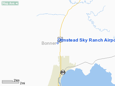
Olmstead Sky Ranch Airport |
Location
& QuickFacts
|
FAA
Information Effective: |
2007-07-05 |
|
Airport
Identifier: |
ID25 |
|
Airport
Status: |
Operational |
|
Longitude/Latitude: |
116-33-14.6990W/48-21-02.7300N
-116.554083/48.350758 (Estimated) |
|
Elevation: |
2140 ft / 652.27 m (Estimated) |
|
Land: |
0 acres |
|
From
nearest city: |
4 nautical miles N of Sandpoint, ID |
|
Location: |
Bonner County, ID |
|
Magnetic
Variation: |
19E (1985) |
Owner
& Manager
|
Ownership: |
Privately
owned |
|
Owner: |
Merle L. Olmstead |
|
Address: |
8200 North Boyer
Sandpoint, ID 83864 |
|
Phone
number: |
208-263-0354 |
|
Address: |
|
Airport
Operations and Facilities
|
Airport
Use: |
Private |
|
Wind
indicator: |
Yes |
|
Segmented Circle: |
No |
|
Control
Tower: |
No |
|
Landing
fee charge: |
No |
|
Sectional chart: |
Great Falls |
|
Region: |
ANM - Northwest Mountain |
|
Boundary
ARTCC: |
ZSE - Seattle |
|
Tie-in
FSS: |
BOI - Boise |
|
FSS
on Airport: |
No |
|
FSS
Phone: |
208-332-0200 |
|
FSS
Toll Free: |
1-800-WX-BRIEF |
|
Runway Information
Runway 16/34
|
Dimension: |
3000 x 50 ft / 914.4 x 15.2 m
1000' OVERRUN ON SOUTH END. |
|
Surface: |
TURF, |
|
|
Runway 16 |
Runway 34 |
|
Traffic
Pattern: |
Left |
Right |
|
Radio Navigation
Aids
|
ID |
Type |
Name |
Ch |
Freq |
Var |
Dist |
|
SZT |
NDB |
Sandpoe |
|
264.00 |
20E |
3.6 nm |
|
ION |
NDB |
Ione |
|
379.00 |
21E |
40.5 nm |
|
DPY |
NDB |
Deer Park |
|
216.00 |
19E |
41.9 nm |
|
LYI |
NDB |
Libby |
|
414.00 |
17E |
42.4 nm |
|
COE |
VOR/DME |
Coeur D'alene |
025X |
108.80 |
19E |
36.3 nm |
Remarks
- E111
PRVDD ALL TFC PATS ARE FLOWN EAST OF ARPT & OPNS WI TFC PATS ARE
RSTRD TO WI 1 NM SOUTH OF ARPT.
Based
Aircraft
|
Aircraft
based on field: |
5 |
|
Single
Engine Airplanes: |
5 |
Olmstead Sky Ranch Airport
Address:
Bonner County, ID
Tel:
208-263-0354
Images
and information placed above are from
http://www.airport-data.com/airport/ID25/
We
thank them for the data!
| General
Info |
| Country |
United
States |
| State |
IDAHO
|
| FAA ID |
ID25 |
| Latitude |
48-21-02.730N
|
| Longitude |
116-33-14.699W
|
| Elevation |
2140 feet
|
| Near City |
SANDPOINT
|
We don't guarantee the information is fresh and accurate. The data may
be wrong or outdated.
For more up-to-date information please refer to other sources.
|


