 |
|
|
|
|
|
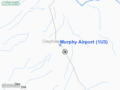
Location
& QuickFacts
|
FAA
Information Effective: |
2007-07-05 |
|
Airport
Identifier: |
1U3 |
|
Airport
Status: |
Operational |
|
Longitude/Latitude: |
116-32-56.4300W/43-12-57.5850N
-116.549008/43.215996 (Estimated) |
|
Elevation: |
2855 ft / 870.20 m (Estimated) |
|
Land: |
10 acres |
|
From
nearest city: |
0 nautical miles E of Murphy, ID |
|
Location: |
Owyhee County, ID |
|
Magnetic
Variation: |
17E (1985) |
Owner
& Manager
|
Ownership: |
Publicly
owned |
|
Owner: |
Owyhee County |
|
Address: |
P.o. Box 128
Murphy, ID 83650 |
|
Phone
number: |
208-495-2421 |
|
Manager: |
Gary Aman |
|
Address: |
Po Box 128
Murphy, ID 83650 |
|
Phone
number: |
208-495-1154 |
Airport
Operations and Facilities
|
Airport
Use: |
Open
to public |
|
Wind
indicator: |
Yes |
|
Segmented Circle: |
No |
|
Control
Tower: |
No |
|
Landing
fee charge: |
No |
|
Sectional chart: |
Salt Lake City |
|
Region: |
ANM - Northwest Mountain |
|
Boundary
ARTCC: |
ZLC - Salt Lake City |
|
Tie-in
FSS: |
BOI - Boise |
|
FSS
on Airport: |
No |
|
FSS
Phone: |
208-332-0200 |
|
FSS
Toll Free: |
1-800-WX-BRIEF |
|
NOTAMs
Facility: |
BOI (NOTAM-d service avaliable) |
Airport
Communications
Airport
Services
|
Airframe
Repair: |
NONE |
|
Power
Plant Repair: |
NONE |
|
Bottled
Oxygen: |
NONE |
|
Bulk
Oxygen: |
NONE |
|
Runway Information
Runway 12/30
|
Dimension: |
2500
x 45 ft / 762.0 x 13.7 m |
|
Surface: |
ASPH, Good Condition |
|
|
Runway 12 |
Runway 30 |
|
Traffic
Pattern: |
Left |
Left |
|
Markings: |
Numbers only,
RWY 12 /30 THLDS MKD WITH PAINTED ROCKS. |
Numbers only, |
|
Obstruction: |
5 ft road, 200.0 ft from runway
RWY 12 +3 FT FENCE 20 FT FM RY END 60 FT L; +10 FT ROAD FM
RY END 100 FT R; +6 FT SIGN AT 20 FT 80 FT R. |
18 ft road, 200.0 ft from runway, 100 ft left
of centerline
+17 FT RD 0 FT FM RY END 100 FT L; +10 FT ROAD AT 50 FT ON
CNTRLN. |
|
Radio Navigation
Aids
|
ID |
Type |
Name |
Ch |
Freq |
Var |
Dist |
|
MPA |
NDB |
Meridian |
|
238.00 |
16E |
23.3 nm |
|
BO |
NDB |
Ustik |
|
359.00 |
17E |
25.1 nm |
|
STI |
NDB |
Sturgeon |
|
333.00 |
17E |
39.5 nm |
|
MUO |
TACAN |
Mountain Home |
087X |
|
18E |
31.4 nm |
|
LIA |
VOR |
Liberator |
|
114.90 |
18E |
36.8 nm |
|
BOI |
VORTAC |
Boise |
080X |
113.30 |
17E |
25.6 nm |
|
BOI |
VOT |
Boise |
|
116.70 |
|
25.5 nm |
Remarks
- NUMEROUS
SIGNS TO +12' ON BOTH SIDES OF HIGHWAY ADJACENT TO RY.
- RY
30 HAS 150 FT PLINE & TERRAIN AT 3000 FT ON CNTRLN.
- EXISTED
PRIOR TO 4/2/59.
Operational
Statistics
Time Period: 2003-02-28
- 2004-02-27
|
Aircraft
Operations: |
120/Week |
|
General
Aviation Itinerant: |
93.5% |
|
Military: |
6.5% |
Murphy Airport
Address:
Owyhee County, ID
Tel:
208-495-2421,
208-495-1154
Images
and information placed above are from
http://www.airport-data.com/airport/1U3/
We
thank them for the data!
| General
Info |
| Country |
United
States |
| State |
IDAHO
|
| FAA ID |
1U3 |
| Latitude |
43-12-57.585N
|
| Longitude |
116-32-56.430W
|
| Elevation |
2855 feet
|
| Near City |
MURPHY
|
We don't guarantee the information is fresh and accurate. The data may
be wrong or outdated.
For more up-to-date information please refer to other sources.
|
|


