 |
|
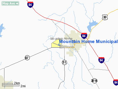
Mountain Home Municipal Airport |
|
|
Location
& QuickFacts
|
FAA
Information Effective: |
2007-07-05 |
|
Airport
Identifier: |
U76 |
|
Airport
Status: |
Operational |
|
Longitude/Latitude: |
115-43-46.5400W/43-07-52.5100N
-115.729594/43.131253 (Estimated) |
|
Elevation: |
3164 ft / 964.39 m (Surveyed) |
|
Land: |
443 acres |
|
From
nearest city: |
2 nautical miles W of Mountain Home, ID |
|
Location: |
Elmore County, ID |
|
Magnetic
Variation: |
17E (1985) |
Owner
& Manager
|
Ownership: |
Publicly
owned |
|
Owner: |
City Of Mountain Home |
|
Address: |
Po Box 10
Mountain Home, ID 83647 |
|
Phone
number: |
208-587-2104 |
|
Manager: |
Arnold Borreson |
|
Address: |
2610 Airbase Rd
Mountain Home, ID 83647 |
|
Phone
number: |
208-587-3585 |
Airport
Operations and Facilities
|
Airport
Use: |
Open
to public |
|
Wind
indicator: |
Yes |
|
Segmented Circle: |
Yes |
|
Control
Tower: |
No |
|
Lighting
Schedule: |
DUSK-DAWN
ACTVT MIRL RY 10/28, PAPIS RY 10 AND RY 28, AND REILS RY
10 AND RY 28 - CTAF. |
|
Beacon
Color: |
Clear-Green (lighted land airport) |
|
Landing
fee charge: |
No |
|
Sectional chart: |
Salt Lake City |
|
Region: |
ANM - Northwest Mountain |
|
Boundary
ARTCC: |
ZLC - Salt Lake City |
|
Tie-in
FSS: |
BOI - Boise |
|
FSS
on Airport: |
No |
|
FSS
Phone: |
208-332-0200 |
|
FSS
Toll Free: |
1-800-WX-BRIEF |
|
NOTAMs
Facility: |
BOI (NOTAM-d service avaliable) |
|
Federal
Agreements: |
NGY |
Airport
Communications
|
CTAF: |
122.800 |
|
Unicom: |
122.800
|
Airport
Services
|
Fuel
available: |
100LL
FUEL AVBL 24 HRS WITH CREDIT CARD. |
|
Airframe
Repair: |
MAJOR |
|
Power
Plant Repair: |
MAJOR |
|
Bottled
Oxygen: |
NONE |
|
Bulk
Oxygen: |
NONE |
|
Runway Information
Runway 10/28
|
Dimension: |
5000
x 75 ft / 1524.0 x 22.9 m |
|
Surface: |
ASPH, Good Condition |
|
Weight
Limit: |
Single wheel: 42000 lbs.
Dual wheel: 53000 lbs. |
|
Edge
Lights: |
Medium |
|
|
Runway 10 |
Runway 28 |
|
Longitude: |
115-44-16.7140W |
115-43-16.3700W |
|
Latitude: |
43-08-03.5210N |
43-07-41.5000N |
|
Elevation: |
3164.00 ft |
3155.00 ft |
|
Alignment: |
116 |
127 |
|
Traffic
Pattern: |
Left |
Left |
|
Markings: |
Basic, Good Condition |
Non-precision instrument, Good Condition |
|
Crossing
Height: |
40.00 ft |
33.00 ft |
|
VASI: |
2-light PAPI on left side |
2-light PAPI on left side |
|
Visual
Glide Angle: |
3.00° |
3.00° |
|
Runway
End Identifier: |
Yes |
Yes |
|
Obstruction: |
10 ft fence, 630.0 ft from runway, 43:1 slope
to clear |
37 ft pline, 1500.0 ft from runway, 35:1 slope
to clear |
|
Radio Navigation
Aids
|
ID |
Type |
Name |
Ch |
Freq |
Var |
Dist |
|
STI |
NDB |
Sturgeon |
|
333.00 |
17E |
3.3 nm |
|
BO |
NDB |
Ustik |
|
359.00 |
17E |
37.9 nm |
|
MPA |
NDB |
Meridian |
|
238.00 |
16E |
45.3 nm |
|
HDG |
NDB |
Steelhead |
|
211.00 |
16E |
48.1 nm |
|
MUO |
TACAN |
Mountain Home |
087X |
|
18E |
8.4 nm |
|
LIA |
VOR |
Liberator |
|
114.90 |
18E |
9.1 nm |
|
BOI |
VORTAC |
Boise |
080X |
113.30 |
17E |
32.4 nm |
|
BOI |
VOT |
Boise |
|
116.70 |
|
34.3 nm |
Remarks
- HIGH
PERFORMANCE MIL JET OPNS CONDUCTED AT MOUNTAIN HOME AFB 8 NM SW OF ARPT.
- EXTENSIVE
AGRICULTURAL OPERATIONS.
Based
Aircraft
|
Aircraft
based on field: |
27 |
|
Single
Engine Airplanes: |
25 |
|
Multi
Engine Airplanes: |
2 |
Operational Statistics
Time Period: 2005-12-20
- 2006-12-19
|
Aircraft
Operations: |
62/Day |
|
General
Aviation Local: |
66.7% |
|
General
Aviation Itinerant: |
26.7% |
|
Military: |
6.7% |
Mountain Home Municipal Airport
Address:
Elmore County, ID
Tel:
208-587-2104,
208-587-3585
Images
and information placed above are from
http://www.airport-data.com/airport/U76/
We
thank them for the data!
| General
Info |
| Country |
United
States |
| State |
IDAHO
|
| FAA ID |
U76 |
| Latitude |
43-07-52.510N
|
| Longitude |
115-43-46.540W
|
| Elevation |
3164 feet
|
| Near City |
MOUNTAIN
HOME |
We don't guarantee the information is fresh and accurate. The data may
be wrong or outdated.
For more up-to-date information please refer to other sources.
|
|


