 |
|
|
|
|
|
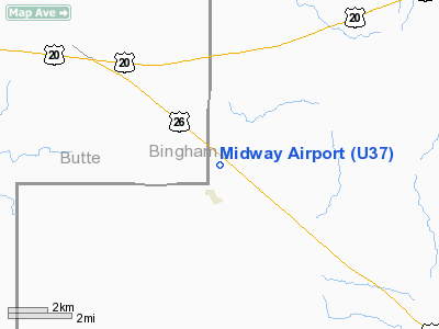
Location
& QuickFacts
|
FAA
Information Effective: |
2007-07-05 |
|
Airport
Identifier: |
U37 |
|
Airport
Status: |
Operational |
|
Longitude/Latitude: |
112-48-32.9700W/43-27-29.6720N
-112.809158/43.458242 (Estimated) |
|
Elevation: |
5017 ft / 1529.18 m (Surveyed) |
|
Land: |
30 acres |
|
From
nearest city: |
1 nautical miles NE of Atomic City, ID |
|
Location: |
Bingham County, ID |
|
Magnetic
Variation: |
16E (1985) |
Owner
& Manager
|
Ownership: |
Publicly
owned |
|
Owner: |
State Of Id, Itd Div Of Aero |
|
Address: |
P.o. Box 7129
Boise, ID 83707-1129 |
|
Phone
number: |
208-334-8775 |
|
Manager: |
Div Admin |
|
Address: |
P.o. Box 7129
Boise, ID 83707-1129 |
|
Phone
number: |
208-334-8775 |
Airport
Operations and Facilities
|
Airport
Use: |
Open
to public |
|
Wind
indicator: |
Yes |
|
Segmented Circle: |
Yes |
|
Control
Tower: |
No |
|
Landing
fee charge: |
No |
|
Sectional chart: |
Salt Lake City |
|
Region: |
ANM - Northwest Mountain |
|
Boundary
ARTCC: |
ZLC - Salt Lake City |
|
Tie-in
FSS: |
BOI - Boise |
|
FSS
on Airport: |
No |
|
FSS
Phone: |
208-332-0200 |
|
FSS
Toll Free: |
1-800-WX-BRIEF |
|
NOTAMs
Facility: |
BOI (NOTAM-d service avaliable) |
Airport
Communications
Airport
Services
|
Airframe
Repair: |
NONE |
|
Power
Plant Repair: |
NONE |
|
Bottled
Oxygen: |
NONE |
|
Bulk
Oxygen: |
NONE |
|
Runway Information
Runway 02/20
|
Dimension: |
3800
x 175 ft / 1158.2 x 53.3 m |
|
Surface: |
GRVL-DIRT, Fair Condition
FIRST 1500' OF RY 02 IS DIRT; REMAINDER OF RY IS GRVL. |
|
|
Runway 02 |
Runway 20 |
|
Traffic
Pattern: |
Left |
Left |
|
Obstruction: |
17 ft road, 100 ft right of centerline |
17 ft road, 270.0 ft from runway, 15:1 slope
to clear |
|
Radio Navigation
Aids
|
ID |
Type |
Name |
Ch |
Freq |
Var |
Dist |
|
AOC |
NDB |
Arco |
|
200.00 |
15E |
24.7 nm |
|
SWU |
NDB |
Sweden |
|
350.00 |
15E |
28.3 nm |
|
IDA |
VOR/DME |
Idaho Falls |
85Y |
113.85 |
15E |
32.7 nm |
|
PIH |
VORTAC |
Pocatello |
073X |
112.60 |
17E |
36.0 nm |
|
DBS |
VORTAC |
Dubois |
116X |
116.90 |
15E |
46.0 nm |
Remarks
- NO
WINTER MAINT.
- +5
FT HEAVY SAGEBRUSH ADJACENT TO BOTH RY EDGES.
- RY
02 +14 FT POSTS AT 400 FT ON CNTRLN.
- ESTABD
PRIOR TO 1959.
Operational
Statistics
Time Period: 2003-11-25
- 2004-11-23
|
Aircraft
Operations: |
34/Month |
|
General
Aviation Itinerant: |
100.0% |
Midway Airport
Address:
Bingham County, ID
Tel:
208-334-8775
Images
and information placed above are from
http://www.airport-data.com/airport/U37/
We
thank them for the data!
| General
Info |
| Country |
United
States |
| State |
IDAHO
|
| FAA ID |
U37 |
| Latitude |
43-27-29.672N
|
| Longitude |
112-48-32.970W
|
| Elevation |
5017 feet
|
| Near City |
ATOMIC
CITY |
We don't guarantee the information is fresh and accurate. The data may
be wrong or outdated.
For more up-to-date information please refer to other sources.
|
|


