 |
|
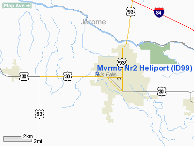
Magic Valley Regional Med Center Nr 2 Heliport |
|
|
Location
& QuickFacts
|
FAA
Information Effective: |
2007-07-05 |
|
Airport
Identifier: |
ID99 |
|
Airport
Status: |
Operational |
|
Longitude/Latitude: |
114-29-42.1400W/42-34-02.6700N
-114.495039/42.567408 (Estimated) |
|
Elevation: |
3680 ft / 1121.66 m (Estimated) |
|
Land: |
0 acres |
|
From
nearest city: |
2 nautical miles N of Twin Falls, ID |
|
Location: |
Twin Falls County, ID |
|
Magnetic
Variation: |
16E (1995) |
Owner
& Manager
|
Ownership: |
Privately
owned |
|
Owner: |
Magic Valley Regionl Med Center |
|
Address: |
650 Addison Ave West
Twin Falls, ID 83301 |
|
Phone
number: |
208-737-2017 |
|
Manager: |
Marc Harrison |
|
Address: |
650 Addison Ave West
Twin Falls, ID 83301 |
|
Phone
number: |
208-737-2017 |
Airport
Operations and Facilities
|
Airport Use: |
Private |
|
Wind
indicator: |
Yes |
|
Segmented
Circle: |
No |
|
Control
Tower: |
No |
|
Lighting
Schedule: |
DUSK-DAWN |
|
Sectional
chart: |
Salt Lake City |
|
Region: |
ANM - Northwest Mountain |
|
Boundary
ARTCC: |
ZLC - Salt Lake City |
|
Tie-in
FSS: |
BOI - Boise |
|
FSS
Phone: |
208-332-0200 |
|
FSS
Toll Free: |
1-800-WX-BRIEF |
Airport
Services
|
Runway Information
Helipad H1
|
Dimension: |
30
x 30 ft / 9.1 x 9.1 m |
|
Surface: |
CONC, |
|
|
Runway H1 |
Runway |
|
Traffic
Pattern: |
Left |
Left |
|
Radio Navigation
Aids
|
ID |
Type |
Name |
Ch |
Freq |
Var |
Dist |
|
HDG |
NDB |
Steelhead |
|
211.00 |
16E |
22.4 nm |
|
HLE |
NDB/DME |
Hailey |
025X |
220.00 |
16E |
47.1 nm |
|
BYI |
VOR/DME |
Burley |
088X |
114.10 |
18E |
27.9 nm |
|
TWF |
VORTAC |
Twin Falls |
105X |
115.80 |
18E |
5.3 nm |
Remarks
Based
Aircraft
|
Aircraft
based on field: |
1 |
|
Helicopters: |
1 |
Magic Valley Regional Med Center Nr2 Heliport
Address:
Twin Falls County, ID
Tel:
208-737-2017
Images
and information placed above are from
http://www.airport-data.com/airport/ID99/
We
thank them for the data!
| General
Info |
| Country |
United
States |
| State |
IDAHO
|
| FAA ID |
ID99 |
| Latitude |
42-34-02.670N
|
| Longitude |
114-29-42.140W
|
| Elevation |
3680 feet
|
| Near City |
TWIN FALLS
|
We don't guarantee the information is fresh and accurate. The data may
be wrong or outdated.
For more up-to-date information please refer to other sources.
|
|


