 |
|
|
|
|
|
Location
& QuickFacts
|
FAA
Information Effective: |
2007-07-05 |
|
Airport
Identifier: |
S77 |
|
Airport
Status: |
Operational |
|
Longitude/Latitude: |
116-15-48.6460W/47-50-14.6970N
-116.263513/47.837416 (Estimated) |
|
Elevation: |
3002 ft / 915.01 m (Estimated) |
|
Land: |
20 acres |
|
From
nearest city: |
23 nautical miles NE of Coeur D Alene, ID |
|
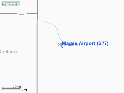
Location: |
Shoshone County, ID |
|
Magnetic Variation: |
19E (1985) |
Owner
& Manager
|
Ownership: |
Publicly
owned |
|
Owner: |
State Of Idaho Itd, Div Aero |
|
Address: |
Box 7129
Boise, ID 83707-1129 |
|
Phone number: |
208-334-8775 |
|
Manager: |
Division Admin |
|
Address: |
Box 7129
Boise, ID 83707-1129 |
|
Phone number: |
208-334-8775 |
Airport
Operations and Facilities
|
Airport
Use: |
Open
to public |
|
Wind
indicator: |
Yes |
|
Segmented Circle: |
Yes |
|
Control
Tower: |
No |
|
Landing
fee charge: |
No |
|
Sectional chart: |
Great Falls |
|
Region: |
ANM - Northwest Mountain |
|
Boundary
ARTCC: |
ZSE - Seattle |
|
Tie-in
FSS: |
BOI - Boise |
|
FSS
on Airport: |
No |
|
FSS
Phone: |
208-332-0200 |
|
FSS
Toll Free: |
1-800-WX-BRIEF |
|
NOTAMs
Facility: |
BOI (NOTAM-d service avaliable) |
Airport Communications
Airport Services
|
Airframe
Repair: |
NONE |
|
Power
Plant Repair: |
NONE |
|
Bottled
Oxygen: |
NONE |
|
Bulk
Oxygen: |
NONE |
|
Runway Information
Runway 18/36
|
Dimension: |
2450 x 150 ft / 746.8 x 45.7 m
FIRST 300 FT OF N END VERY ROUGH. |
|
Surface: |
TURF, Good Condition |
|
|
Runway 18 |
Runway 36 |
|
Traffic
Pattern: |
Left |
Left |
|
Displaced
threshold: |
300.00 ft |
0.00 ft |
|
Obstruction: |
30 ft brush, 10.0 ft from runway
DSPLCD FOR 30' BRUSH AT 10' ON CNTRLN, 10:1 APCH SLOPE TO
DSPLCD THR. |
300 ft ridge, 900.0 ft from runway, 200 ft
left of centerline, 3:1 slope to clear |
|
Radio Navigation
Aids
|
ID |
Type |
Name |
Ch |
Freq |
Var |
Dist |
|
SZT |
NDB |
Sandpoe |
|
264.00 |
20E |
29.8 nm |
|
LYI |
NDB |
Libby |
|
414.00 |
17E |
41.7 nm |
|
SFF |
NDB |
Felts |
|
365.00 |
19E |
43.3 nm |
|
DPY |
NDB |
Deer Park |
|
216.00 |
19E |
47.5 nm |
|
COE |
VOR/DME |
Coeur D'alene |
025X |
108.80 |
19E |
22.8 nm |
|
MLP |
VOR/DME |
Mullan Pass |
125X |
117.80 |
20E |
33.9 nm |
|
SFF |
VOT |
Spokane/felts Field |
|
114.00 |
|
43.7 nm |
Remarks
- NO
WINTER MAINT.
- RCMD
LAND RWY 18; TKOF RWY 36 WHEN WIND CONDS PERMIT.
- HEAVY
SNOWMOBLILE ACTIVITY DURING WINTER MONTHS.
- RY
18/36 NORTH 100 FT CLOSED APRIL 1ST - JUL 15TH.
- ESTABD
PRIOR TO 5/15/59.
Operational
Statistics
Time Period: 2003-08-21
- 2004-08-19
|
Aircraft
Operations: |
24/Week |
|
Air
Taxi: |
8.3% |
|
General
Aviation Itinerant: |
91.7% |
Magee Airport
Address:
Shoshone County, ID
Tel:
208-334-8775
Images
and information placed above are from
http://www.airport-data.com/airport/S77/
We
thank them for the data!
| General
Info |
| Country |
United
States |
| State |
IDAHO
|
| FAA ID |
S77 |
| Latitude |
47-50-14.697N
|
| Longitude |
116-15-48.646W
|
| Elevation |
3002 feet
|
| Near City |
COEUR
D ALENE |
We don't guarantee the information is fresh and accurate. The data may
be wrong or outdated.
For more up-to-date information please refer to other sources.
|
|


