 |
|
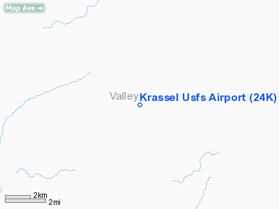
Krassel U.S. Forest Service Airport |
|
|
Location
& QuickFacts
|
FAA
Information Effective: |
2007-07-05 |
|
Airport
Identifier: |
24K |
|
Airport
Status: |
Operational |
|
Longitude/Latitude: |
115-43-47.4340W/44-58-27.6410N
-115.729843/44.974345 (Estimated) |
|
Elevation: |
3982 ft / 1213.71 m (Estimated) |
|
Land: |
6 acres |
|
From
nearest city: |
17 nautical miles NE of Mc Call, ID |
|
Location: |
Valley County, ID |
|
Magnetic Variation: |
18E (1985) |
Owner
& Manager
|
Ownership: |
Publicly
owned |
|
Owner: |
Us Forest Service |
|
Address: |
324 25th St
Ogden, UT 84401 |
|
Phone
number: |
801-625-5511 |
|
Manager: |
Krassel District Ranger |
|
Address: |
P.o. Box 1026
Mc Call, ID 83638 |
|
Phone number: |
208-634-0601 |
Airport Operations and Facilities
|
Airport
Use: |
Open
to public |
|
Wind
indicator: |
Yes |
|
Segmented Circle: |
No |
|
Control
Tower: |
No |
|
Sectional chart: |
Great Falls |
|
Region: |
ANM - Northwest Mountain |
|
Boundary
ARTCC: |
ZLC - Salt Lake City |
|
Tie-in
FSS: |
BOI - Boise |
|
FSS
Phone: |
208-332-0200 |
|
FSS
Toll Free: |
1-800-WX-BRIEF |
|
NOTAMs
Facility: |
BOI (NOTAM-d service avaliable) |
Airport
Communications
|
Runway Information
Runway 17/35
|
Dimension: |
1500 x 150 ft / 457.2 x 45.7 m
MAY NOT BE MOWED TO FULL WIDTH. |
|
Surface: |
TURF, Fair Condition
RY SURFACE ROUGH DUE TO RODENT HOLES. |
|
|
Runway 17 |
Runway 35 |
|
Traffic
Pattern: |
Left |
Left |
|
Obstruction: |
45 ft tree, 70 ft left of centerline |
40 ft trees, 100.0 ft from runway, 75L/ ft
right of centerline, 3:1 slope to clear |
|
Radio Navigation
Aids
|
ID |
Type |
Name |
Ch |
Freq |
Var |
Dist |
|
IOM |
NDB |
Mc Call |
|
363.00 |
17E |
18.8 nm |
|
DNJ |
VORTAC |
Donnelly |
109X |
116.20 |
19E |
23.8 nm |
Remarks
- EXTSV
HELICOPTER OPNS DURING SUMMER MONTHS.
- +80'
TO +120' TREES ADJ TO BOTH SIDES OF RY.
- CONSIDERABLE
RODENT ACTIVITY ON RY.
- MARKED
PRIVATE USE HELIPAD ON AIRPORT.
Based
Aircraft
|
Aircraft
based on field: |
1 |
|
Helicopters: |
1 |
Operational Statistics
Time Period: 2006-05-08
- 2007-05-07
|
Aircraft
Operations: |
15/Week |
|
Air
Taxi: |
40.0% |
|
General
Aviation Itinerant: |
60.0% |
Krassel U S Forest Service Airport
Address:
Valley County, ID
Tel:
801-625-5511,
208-634-0601
Images
and information placed above are from
http://www.airport-data.com/airport/24K/
We
thank them for the data!
| General
Info |
| Country |
United
States |
| State |
IDAHO
|
| FAA ID |
24K |
| Latitude |
44-58-27.641N
|
| Longitude |
115-43-47.434W
|
| Elevation |
3982 feet
|
| Near City |
MC CALL
|
We don't guarantee the information is fresh and accurate. The data may
be wrong or outdated.
For more up-to-date information please refer to other sources.
|
|


