 |
|
|
|
|
|
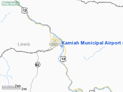
Location
& QuickFacts
|
FAA
Information Effective: |
2007-07-05 |
|
Airport
Identifier: |
S73 |
|
Airport
Status: |
Operational |
|
Longitude/Latitude: |
116-00-48.5050W/46-13-09.6250N
-116.013474/46.219340 (Estimated) |
|
Elevation: |
1194 ft / 363.93 m (Estimated) |
|
Land: |
24 acres |
|
From
nearest city: |
1 nautical miles SE of Kamiah, ID |
|
Location: |
Idaho County, ID |
|
Magnetic Variation: |
18E (1985) |
Owner & Manager
|
Ownership: |
Publicly owned |
|
Owner: |
City Of Kamiah |
|
Address: |
Po Box 338
Kamiah, ID 83536 |
|
Phone number: |
208-935-2672 |
|
Manager: |
Darren Clopton |
|
Address: |
Po Box 338
Kamiah, ID 83536 |
|
Phone number: |
208-935-0319 |
Airport
Operations and Facilities
|
Airport
Use: |
Open
to public |
|
Wind
indicator: |
Yes
WINDSOCK LGTS OTS INDEFLY. |
|
Segmented Circle: |
No |
|
Control
Tower: |
No |
|
Lighting
Schedule: |
RDO-CTL
ACTIVATE LIRL RY 14/32 - CTAF. |
|
Landing
fee charge: |
No |
|
Sectional chart: |
Great Falls |
|
Region: |
ANM - Northwest Mountain |
|
Traffic
Pattern Alt: |
800 ft |
|
Boundary
ARTCC: |
ZSE - Seattle |
|
Tie-in
FSS: |
BOI - Boise |
|
FSS
on Airport: |
No |
|
FSS
Phone: |
208-332-0200 |
|
FSS
Toll Free: |
1-800-WX-BRIEF |
|
NOTAMs
Facility: |
BOI (NOTAM-d service avaliable) |
|
Federal Agreements: |
N |
Airport Communications
Airport
Services
|
Bottled
Oxygen: |
NONE |
|
Bulk
Oxygen: |
NONE |
|
Runway Information
Runway 14/32
|
Dimension: |
3000
x 90 ft / 914.4 x 27.4 m |
|
Surface: |
TURF, Good Condition |
|
Edge
Lights: |
Non-standard lighting system
NSTD LIRL. |
|
|
Runway 14 |
Runway 32 |
|
Traffic
Pattern: |
Right |
Left |
|
Obstruction: |
25 ft brush, 100.0 ft from runway, 4:1 slope
to clear |
3 ft fence, 0.0 ft from runway |
|
Radio Navigation
Aids
|
ID |
Type |
Name |
Ch |
Freq |
Var |
Dist |
|
GVV |
NDB |
Grain |
|
280.00 |
18E |
18.9 nm |
|
MQG |
VOR/DME |
Nez Perce |
019X |
108.20 |
20E |
36.9 nm |
Remarks
- FOR
RWY CONDS DURG WINTER MONTHS CHECK WITH AMGR 208-935-2672.
- NUMEROUS
OBSTNS ON BOTH RY APCHS; DOWNDRAFTS PREVALENT OVER RIVER ON RY 32 APCH.
- CANADIAN
GEESE ON AND INVOF ARPT.
- NOT
RECOMMENDED TRANSIENT PILOTS LAND AFTER DARK WITHOUT FIRST BECOMING
FAMILIAR WITH AIRPORT DUE TO HIGH TERRAIN .5 MI FM RY.
- ESTABD
PRIOR TO 5/15/59.
Based
Aircraft
|
Aircraft
based on field: |
9 |
|
Single
Engine Airplanes: |
9 |
Operational Statistics
Time Period: 2005-08-11
- 2006-08-10
|
Aircraft
Operations: |
189/Week |
|
General
Aviation Local: |
20.4% |
|
General
Aviation Itinerant: |
79.6% |
Kamiah Municipal Airport
Address:
Idaho County, ID
Tel:
208-935-2672, 208-935-0319
Images
and information placed above are from
http://www.airport-data.com/airport/S73/
We
thank them for the data!
| General
Info |
| Country |
United
States |
| State |
IDAHO
|
| FAA ID |
S73 |
| Latitude |
46-13-09.625N
|
| Longitude |
116-00-48.505W
|
| Elevation |
1194 feet
|
| Near City |
KAMIAH
|
We don't guarantee the information is fresh and accurate. The data may
be wrong or outdated.
For more up-to-date information please refer to other sources.
|
|


