 |
|
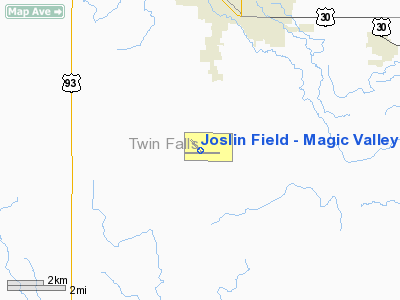
Joslin Field - Magic Valley Regional Airport |
Magic Valley Regional Airport
Joslin Field |
| IATA: TWF â ICAO: KTWF |
| Summary |
| Airport type |
Public |
| Operator |
City & County of Twin Falls |
| Location |
Twin Falls, Idaho |
| Elevation AMSL |
4,151 ft / 1265.2 m |
| Coordinates |
42°28â²54.49â³N 114°29â²15.84â³W / 42.4818028°N 114.4877333°W / 42.4818028; -114.4877333Coordinates: 42°28â²54.49â³N 114°29â²15.84â³W / 42.4818028°N 114.4877333°W / 42.4818028; -114.4877333 |
| Runways |
| Direction |
Length |
Surface |
| ft |
m |
| 7/25 |
8,703 |
2,653 |
Asphalt |
| 12/30 |
3,224 |
983 |
Asphalt |
Magic Valley Regional Airport (IATA: TWF, ICAO: KTWF), also known as Joslin Field- Gateway to the Great Rift, is a public airport located 4 miles (6 km) south of Twin Falls, in Twin Falls County, Idaho, USA. It is mostly used for general aviation but is also served by two commercial airlines. Facilities
Magic Valley Regional Airport covers 1,468 acres (5.94 km) and has two runways:
- Runway 7/25: 8,703 x 150 ft (2,653 x 46 m), Surface: Asphalt
- Runway 12/30: 3,224 x 75 ft (983 x 23 m), Surface: Asphalt
Airlines and destinations
| Airlines |
Destinations |
| Allegiant Air |
Las Vegas |
| Delta Connection operated by SkyWest Airlines |
Salt Lake City |
The above content comes from Wikipedia and is published under free licenses – click here to read more.
Location
& QuickFacts
|
FAA
Information Effective: |
2007-07-05 |
|
Airport
Identifier: |
TWF |
|
Airport
Status: |
Operational |
|
Longitude/Latitude: |
114-29-15.8480W/42-28-54.4940N
-114.487736/42.481804 (Estimated) |
|
Elevation: |
4151 ft / 1265.22 m (Surveyed) |
|
Land: |
1468 acres |
|
From
nearest city: |
4 nautical miles S of Twin Falls, ID |
|
Location: |
Twin Falls County, ID |
|
Magnetic Variation: |
16E (1985) |
Owner
& Manager
|
Ownership: |
Publicly
owned |
|
Owner: |
City & County Of Twin Falls |
|
Address: |
Po Box 1907
Twin Falls, ID 83303 |
|
Phone number: |
208-733-5215 |
|
Manager: |
Bill Carberry |
|
Address: |
Box 1907
Twin Falls, ID 83303 |
|
Phone number: |
208-733-5215 |
Airport
Operations and Facilities
|
Airport
Use: |
Open
to public |
|
Wind
indicator: |
Yes |
|
Segmented Circle: |
Yes |
|
Control
Tower: |
Yes |
|
Lighting
Schedule: |
DUSK-DAWN
WHEN ATCT CLSD ACTVT HIRL RY 07/25, MALSR RY 25 & REIL
RY 07 - CTAF. |
|
Beacon
Color: |
Clear-Green (lighted land airport) |
|
Landing
fee charge: |
Yes
LANDING FEE FOR ALL FAR PART 121, 135 OPERATORS AND GENERAL
AVIATION PART 91 AIRCRAFT GREATER THAN 12,500 LBS MGLW. |
|
Sectional chart: |
Salt Lake City |
|
Region: |
ANM - Northwest Mountain |
|
Boundary
ARTCC: |
ZLC - Salt Lake City |
|
Tie-in
FSS: |
BOI - Boise |
|
FSS
on Airport: |
No |
|
FSS
Phone: |
208-332-0200 |
|
FSS
Toll Free: |
1-800-WX-BRIEF |
|
NOTAMs
Facility: |
TWF (NOTAM-d service avaliable) |
|
Certification type/date: |
II A S 05/197
PPR FOR UNSKED ACR OPNS WITH MORE THAN 30 PSGR SEATS CALL
AMGR 208-733-5215. |
|
Federal Agreements: |
NGY |
Airport Communications
|
CTAF: |
118.200 |
|
Unicom: |
122.950
|
Airport
Services
|
Fuel
available: |
100LLA1+
ADDNL FUEL SVC FEE BTN 2000-0630; CALL 208-733-5920 OR 539-4034
FOR INFO. |
|
Airframe
Repair: |
MAJOR |
|
Power
Plant Repair: |
MAJOR |
|
Bottled
Oxygen: |
HIGH |
|
Bulk
Oxygen: |
HIGH |
|
Runway Information
Runway 07/25
|
Dimension: |
8703
x 150 ft / 2652.7 x 45.7 m |
|
Surface: |
ASPH, Good Condition |
|
Surface
Treatment: |
Porous Friction Course |
|
Weight
Limit: |
Single wheel: 75000 lbs.
Dual wheel: 200000 lbs.
Dual tandem wheel: 250000 lbs. |
|
Edge
Lights: |
High |
|
|
Runway 07 |
Runway 25 |
|
Longitude: |
114-30-11.5930W |
114-28-15.5070W |
|
Latitude: |
42-28-52.5190N |
42-28-50.5580N |
|
Elevation: |
4141.00 ft |
4149.00 ft |
|
Alignment: |
91 |
127 |
|
ILS
Type: |
|
ILS |
|
Traffic
Pattern: |
Left |
Left |
|
Markings: |
Non-precision instrument, Good Condition |
Precision instrument, Good Condition |
|
Crossing
Height: |
50.00 ft |
55.00 ft |
|
VASI: |
4-box on left side |
4-light PAPI on left side |
|
Visual
Glide Angle: |
3.00° |
3.00° |
|
Approach
lights: |
|
MALSR |
|
Runway
End Identifier: |
Yes |
No |
|
Runway 12/30
|
Dimension: |
3224
x 75 ft / 982.7 x 22.9 m |
|
Surface: |
ASPH, Fair Condition |
|
Weight
Limit: |
Single wheel: 19000 lbs. |
|
|
Runway 12 |
Runway 30 |
|
Longitude: |
114-29-36.9170W |
114-29-07.1870W |
|
Latitude: |
42-29-13.9630N |
42-28-50.9550N |
|
Elevation: |
4104.00 ft |
4145.00 ft |
|
Alignment: |
127 |
127 |
|
Traffic
Pattern: |
Left |
Left |
|
Markings: |
Basic, Good Condition |
Basic, Good Condition |
|
Runway
End Identifier: |
No |
No |
|
Obstruction: |
, 50:1 slope to clear |
83 ft ant, 2133.0 ft from runway, 325 ft left
of centerline, 23:1 slope to clear |
|
Radio Navigation
Aids
|
ID |
Type |
Name |
Ch |
Freq |
Var |
Dist |
|
HDG |
NDB |
Steelhead |
|
211.00 |
16E |
27.4 nm |
|
BYI |
VOR/DME |
Burley |
088X |
114.10 |
18E |
28.2 nm |
|
TWF |
VORTAC |
Twin Falls |
105X |
115.80 |
18E |
0.1 nm |
Remarks
- RY
12/30 & TWYS G H J & K NON-ACR MOVEMENT AREA.
Based
Aircraft
|
Aircraft
based on field: |
105 |
|
Single
Engine Airplanes: |
90 |
|
Multi
Engine Airplanes: |
10 |
|
Jet
Engine Airplanes: |
1 |
|
Helicopters: |
4 |
Major Carriers
Serving This Airport
|
Skywest Airlines Inc. |
100.0% |
Most Popular Destinations
|
Salt Lake City Intl (SLC) |
99.8% |
|
Pocatello
Rgnl (PIH) |
0.2% |
Most Popular Aircraft
|
N236SW |
7.3% |
|
N291SW |
6.9% |
|
N224SW |
5.5% |
|
N576SW |
5.2% |
|
N566SW |
5.0% |
|
N216SW |
4.2% |
|
N563SW |
4.0% |
|
N584SW |
4.0% |
|
N581SW |
3.8% |
|
N561SW |
3.6% |
Operational Statistics
Time Period: 2005-01-01
- 2005-12-31
|
Aircraft
Operations: |
109/Day |
|
Commerical: |
0.8% |
|
Air
Taxi: |
28.1% |
|
General
Aviation Local: |
21.7% |
|
General
Aviation Itinerant: |
41.9% |
|
Military: |
7.5% |
Joslin Field - Magic Valley Regional Airport
Address:
Twin Falls County, ID
Tel:
208-733-5215
Images
and information placed above are from
http://www.airport-data.com/airport/TWF/
We
thank them for the data!
| General
Info |
| Country |
United
States |
| State |
IDAHO
|
| FAA ID |
TWF |
| Latitude |
42-28-54.494N
|
| Longitude |
114-29-15.848W
|
| Elevation |
4151 feet
|
| Near City |
TWIN FALLS
|
We don't guarantee the information is fresh and accurate. The data may
be wrong or outdated.
For more up-to-date information please refer to other sources.
|
|


