 |
|
Location
& QuickFacts
|
FAA
Information Effective: |
2007-07-05 |
|
Airport
Identifier: |
ID04 |
|
Airport
Status: |
Operational |
|
Longitude/Latitude: |
111-25-22.7450W/42-01-44.7520N
-111.422985/42.029098 (Estimated) |
|
Elevation: |
6190 ft / 1886.71 m (Estimated) |
|
Land: |
30 acres |
|
From
nearest city: |
1 nautical miles SW of Fish Haven, ID |
|
Location: |
Bear Lake County, ID |
|
Magnetic Variation: |
15E (1990) |
Owner & Manager
|
Ownership: |
Privately owned |
|
Owner: |
Mark Mc Kinnon |
|
Address: |
8343 Ponderosa Lane
Parker, CO 80134 |
|
Phone number: |
303-841-3985 |
|
Manager: |
Mark Mc Kinnon |
|
Address: |
8343 Ponderosa Lane
Parker, CO 80134 |
|
Phone number: |
303-841-3985 |
Airport
Operations and Facilities
|
Airport
Use: |
Private |
|
Wind
indicator: |
Yes |
|
Segmented Circle: |
No |
|
Control
Tower: |
No |
|
Sectional chart: |
Salt Lake City |
|
Region: |
ANM - Northwest Mountain |
|
Boundary
ARTCC: |
ZLC - Salt Lake City |
|
Tie-in
FSS: |
BOI - Boise |
|
FSS
on Airport: |
No |
|
FSS
Phone: |
208-332-0200 |
|
FSS
Toll Free: |
1-800-WX-BRIEF |
|
Runway Information
Runway 08/26
|
Dimension: |
2300
x 30 ft / 701.0 x 9.1 m |
|
Surface: |
GRAVEL, Poor Condition
HAS POT HOLES. |
|
|
Runway 08 |
Runway 26 |
|
Traffic
Pattern: |
Left |
Left |
|
Obstruction: |
40 ft pline, 100.0 ft from runway |
|
|
Radio Navigation
Aids
|
ID |
Type |
Name |
Ch |
Freq |
Var |
Dist |
|
BMC |
NDB |
Brigham City |
|
294.00 |
16E |
42.6 nm |
|
LGU |
VOR/DME |
Logan |
035X |
109.80 |
16E |
22.7 nm |
|
LHO |
VOR/DME |
Brigham City |
076X |
112.90 |
14E |
29.8 nm |
|
MLD |
VOR/DME |
Malad City |
121X |
117.40 |
17E |
47.0 nm |
|
EVW |
VOR/DME |
Evanston |
33X |
109.60 |
13E |
48.5 nm |
Remarks
- LNDG
WEST & TKOF EAST.
- GO
AROUND MUST BE EXECUTED TO THR REQUIRING 90 DEGREE TURN TOWARDS LOWER
TERRAIN.
- HIGHER
THAN STANDARD PILOT PROFICIENCY REQUIRED.
- B
& B ACROSS FM ARPT. POC
ESTHER HARRISON 208-945-2688.
Based
Aircraft
|
Aircraft
based on field: |
1 |
|
Single
Engine Airplanes: |
1 |
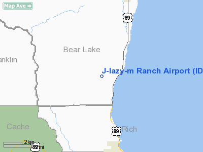
J-lazy-m Ranch Airport
Address:
Bear Lake County, ID
Tel:
303-841-3985
Images
and information placed above are from
http://www.airport-data.com/airport/ID04/
We
thank them for the data!
| General
Info |
| Country |
United
States |
| State |
IDAHO
|
| FAA ID |
ID04 |
| Latitude |
42-01-44.752N
|
| Longitude |
111-25-22.745W
|
| Elevation |
6190 feet
|
| Near City |
FISH HAVEN
|
We don't guarantee the information is fresh and accurate. The data may
be wrong or outdated.
For more up-to-date information please refer to other sources.
|
|


