 |
|
|
|
Location
& QuickFacts
|
FAA
Information Effective: |
2007-07-05 |
|
Airport
Identifier: |
07ID |
|
Airport
Status: |
Operational |
|
Longitude/Latitude: |
113-18-17.9950W/42-16-41.6900N
-113.304999/42.278247 (Estimated) |
|
Elevation: |
4580 ft / 1395.98 m (Estimated) |
|
Land: |
0 acres |
|
From
nearest city: |
3 nautical miles SE of Malta, ID |
|
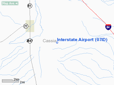
Location: |
Cassia County, ID |
|
Magnetic Variation: |
16E (1985) |
Owner
& Manager
|
Ownership: |
Publicly
owned |
|
Owner: |
Blm
LEASED TO INTERSTATE FEEDERS, INC. |
|
Address: |
|
|
Manager: |
Mike Telford |
|
Address: |
Interstate Feeders Inc
Malta, ID 83342 |
|
Phone number: |
208-645-2221 |
Airport Operations and Facilities
|
Airport Use: |
Private |
|
Wind indicator: |
Yes |
|
Segmented Circle: |
No |
|
Control Tower: |
No |
|
Landing fee charge: |
No |
|
Sectional chart: |
Salt Lake City |
|
Region: |
ANM - Northwest Mountain |
|
Boundary ARTCC: |
ZLC - Salt Lake City |
|
Tie-in FSS: |
BOI - Boise |
|
FSS on Airport: |
No |
|
FSS Phone: |
208-332-0200 |
|
FSS Toll Free: |
1-800-WX-BRIEF |
Airport Services
|
Airframe
Repair: |
NONE |
|
Power
Plant Repair: |
NONE |
|
Bottled
Oxygen: |
NONE |
|
Bulk
Oxygen: |
NONE |
|
Runway
Information
Runway NW/SE
|
Dimension: |
3000
x 75 ft / 914.4 x 22.9 m |
|
Surface: |
TURF-DIRT, |
|
|
Runway NW |
Runway SE |
|
Traffic
Pattern: |
Left |
Left |
|
Markings: |
None, |
None, |
|
Runway
End Identifier: |
No |
No |
|
Centerline
Lights: |
No |
No |
|
Touchdown
Lights: |
No |
No |
|
Radio Navigation
Aids
|
ID |
Type |
Name |
Ch |
Freq |
Var |
Dist |
|
BYI |
VOR/DME |
Burley |
088X |
114.10 |
18E |
30.8 nm |
|
MLD |
VOR/DME |
Malad City |
121X |
117.40 |
17E |
38.3 nm |
|
PIH |
VORTAC |
Pocatello |
073X |
112.60 |
17E |
45.8 nm |
Remarks
- +1'
BERM BOTH SIDES OF RWY.
Interstate Airport
Address:
Cassia County, ID
Tel:
208-645-2221
Images
and information placed above are from
http://www.airport-data.com/airport/07ID/
We
thank them for the data!
| General
Info |
| Country |
United
States |
| State |
IDAHO
|
| FAA ID |
07ID |
| Latitude |
42-16-41.690N
|
| Longitude |
113-18-17.995W
|
| Elevation |
4580 feet
|
| Near City |
MALTA
|
We don't guarantee the information is fresh and accurate. The data may
be wrong or outdated.
For more up-to-date information please refer to other sources.
|
|


