 |
|
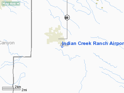
Indian Creek Ranch Airport |
Location
& QuickFacts
|
FAA
Information Effective: |
2007-07-05 |
|
Airport
Identifier: |
3ID7 |
|
Airport
Status: |
Operational |
|
Longitude/Latitude: |
116-24-16.0200W/43-28-33.6600N
-116.404450/43.476017 (Estimated) |
|
Elevation: |
2674 ft / 815.04 m (Estimated) |
|
Land: |
9 acres |
|
From
nearest city: |
2 nautical miles S of Kuna, ID |
|
Location: |
Ada County, ID |
|
Magnetic Variation: |
16E (2000) |
Owner & Manager
|
Ownership: |
Privately owned |
|
Owner: |
Jeffrey Welker |
|
Address: |
301 North 27th
Boise, ID 83702 |
|
Phone number: |
208-343-2585 |
|
Manager: |
Jeffrey Welker |
|
Address: |
301 North 27th
Boise, ID 83702 |
|
Phone number: |
208-343-2585 |
Airport
Operations and Facilities
|
Airport
Use: |
Private |
|
Segmented Circle: |
No |
|
Control
Tower: |
No |
|
Sectional chart: |
Salt Lake City |
|
Region: |
ANM - Northwest Mountain |
|
Boundary
ARTCC: |
ZLC - Salt Lake City |
|
Tie-in
FSS: |
BOI - Boise |
|
FSS
Phone: |
208-332-0200 |
|
FSS
Toll Free: |
1-800-WX-BRIEF |
|
Runway Information
Runway 08/26
|
Dimension: |
1200
x 250 ft / 365.8 x 76.2 m |
|
Surface: |
TURF, Good Condition |
|
|
Runway 08 |
Runway 26 |
|
Traffic
Pattern: |
Left |
Left |
|
Obstruction: |
25 ft |
35 ft pline, 8.0 ft from runway |
|
Runway 17/35
|
Dimension: |
1000
x 120 ft / 304.8 x 36.6 m |
|
Surface: |
TURF, Good Condition |
|
|
Runway 17 |
Runway 35 |
|
Traffic
Pattern: |
Left |
Left |
|
Radio Navigation
Aids
|
ID |
Type |
Name |
Ch |
Freq |
Var |
Dist |
|
BO |
NDB |
Ustik |
|
359.00 |
17E |
8.2 nm |
|
MPA |
NDB |
Meridian |
|
238.00 |
16E |
9.6 nm |
|
STI |
NDB |
Sturgeon |
|
333.00 |
17E |
39.2 nm |
|
ONO |
NDB |
Ontario |
|
305.00 |
17E |
41.9 nm |
|
MUO |
TACAN |
Mountain Home |
087X |
|
18E |
35.0 nm |
|
LIA |
VOR |
Liberator |
|
114.90 |
18E |
40.5 nm |
|
BOI |
VORTAC |
Boise |
080X |
113.30 |
17E |
10.3 nm |
|
BOI |
VOT |
Boise |
|
116.70 |
|
9.5 nm |
Based
Aircraft
|
Aircraft
based on field: |
1 |
|
Single
Engine Airplanes: |
1 |
Indian Creek Ranch Airport
Address:
Ada County, ID
Tel:
208-343-2585
Images
and information placed above are from
http://www.airport-data.com/airport/3ID7/
We
thank them for the data!
| General
Info |
| Country |
United
States |
| State |
IDAHO
|
| FAA ID |
3ID7 |
| Latitude |
43-28-33.660N
|
| Longitude |
116-24-16.020W
|
| Elevation |
2674 feet
|
| Near City |
KUNA |
We don't guarantee the information is fresh and accurate. The data may
be wrong or outdated.
For more up-to-date information please refer to other sources.
|
|


