 |
|
|
|
|
|
Location
& QuickFacts
|
FAA
Information Effective: |
2007-07-05 |
|
Airport
Identifier: |
S80 |
|
Airport
Status: |
Operational |
|
Longitude/Latitude: |
116-07-24.2970W/45-56-33.2090N
-116.123416/45.942558 (Estimated) |
|
Elevation: |
3310 ft / 1008.89 m (Surveyed) |
|
Land: |
161 acres |
|
From
nearest city: |
1 nautical miles N of Grangeville, ID |
|
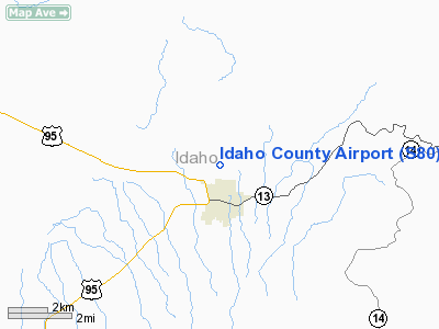
Location: |
Idaho County, ID |
|
Magnetic Variation: |
17E (1995) |
Owner
& Manager
|
Ownership: |
Publicly
owned |
|
Owner: |
Idaho County |
|
Address: |
320 W Main
Grangeville, ID 83530 |
|
Phone
number: |
208-983-2751 |
|
Manager: |
Jon Stroop |
|
Address: |
320 W Main St
Grangeville, ID 83530 |
|
Phone number: |
208-926-4471 |
Airport Operations and Facilities
|
Airport
Use: |
Open
to public |
|
Wind
indicator: |
Yes |
|
Segmented Circle: |
Yes |
|
Control
Tower: |
No |
|
Lighting
Schedule: |
DUSK-DAWN
ACTVT REIL RY 07 - CTAF. |
|
Beacon
Color: |
Clear-Green (lighted land airport) |
|
Landing
fee charge: |
No |
|
Sectional chart: |
Great Falls |
|
Region: |
ANM - Northwest Mountain |
|
Boundary
ARTCC: |
ZSE - Seattle |
|
Tie-in
FSS: |
BOI - Boise |
|
FSS
on Airport: |
No |
|
FSS
Phone: |
208-332-0200 |
|
FSS
Toll Free: |
1-800-WX-BRIEF |
|
NOTAMs
Facility: |
BOI (NOTAM-d service avaliable) |
|
Federal Agreements: |
NGY |
Airport Communications
Airport
Services
|
Fuel
available: |
100LLA
24 HR SELF SVC CREDIT CARD FUELING FAC. |
|
Airframe
Repair: |
MINOR |
|
Power
Plant Repair: |
MINOR |
|
Bottled
Oxygen: |
NONE |
|
Bulk
Oxygen: |
NONE |
|
Runway Information
Runway 07/25
|
Dimension: |
5100
x 75 ft / 1554.5 x 22.9 m |
|
Surface: |
ASPH, Good Condition |
|
Weight
Limit: |
Single wheel: 75000 lbs.
Dual wheel: 95000 lbs.
Dual tandem wheel: 145000 lbs. |
|
Edge
Lights: |
Medium |
|
|
Runway 07 |
Runway 25 |
|
Longitude: |
116-08-00.3790W |
116-06-48.2150W |
|
Latitude: |
45-56-33.4760N |
45-56-32.9420N |
|
Elevation: |
3282.00 ft |
3310.00 ft |
|
Alignment: |
91 |
127 |
|
Traffic
Pattern: |
Left |
Left |
|
Markings: |
Non-precision instrument, Good Condition |
Non-precision instrument, Good Condition |
|
Displaced
threshold: |
100.00 ft |
0.00 ft |
|
Runway
End Identifier: |
Yes |
|
|
Obstruction: |
2 ft road, 235.0 ft from runway, 17:1 slope
to clear
RWY 07 DSPLCD FOR +2' ROAD AT 235' ON CNTRLN, 20:1 APCH SLOPE
TO DSPLCD THR. |
, 50:1 slope to clear |
|
Radio Navigation
Aids
|
ID |
Type |
Name |
Ch |
Freq |
Var |
Dist |
|
GVV |
NDB |
Grain |
|
280.00 |
18E |
4.1 nm |
|
MQG |
VOR/DME |
Nez Perce |
019X |
108.20 |
20E |
40.8 nm |
Remarks
- CONSIDERABLE
USFS FIRE RETARDENT OPERS DURG SUMMER MONTHS.
- PARACHUTE
ACTIVITY MAY THRU AUG.
Based
Aircraft
|
Aircraft
based on field: |
11 |
|
Single
Engine Airplanes: |
10 |
|
Multi
Engine Airplanes: |
1 |
Operational Statistics
Time Period: 2003-05-02
- 2004-04-30
|
Aircraft
Operations: |
47/Day |
|
Air
Taxi: |
20.6% |
|
General
Aviation Local: |
14.7% |
|
General
Aviation Itinerant: |
64.7% |
Idaho County Airport
Address:
Idaho County, ID
Tel:
208-983-2751,
208-926-4471
Images
and information placed above are from
http://www.airport-data.com/airport/S80/
We
thank them for the data!
| General
Info |
| Country |
United
States |
| State |
IDAHO
|
| FAA ID |
S80 |
| Latitude |
45-56-33.209N
|
| Longitude |
116-07-24.297W
|
| Elevation |
3310 feet
|
| Near City |
GRANGEVILLE
|
We don't guarantee the information is fresh and accurate. The data may
be wrong or outdated.
For more up-to-date information please refer to other sources.
|
|


