 |
|
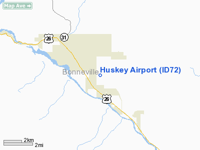
Location
& QuickFacts
|
FAA
Information Effective: |
2007-07-05 |
|
Airport
Identifier: |
ID72 |
|
Airport
Status: |
Operational |
|
Longitude/Latitude: |
111-17-04.8080W/43-25-02.7010N
-111.284669/43.417417 (Estimated) |
|
Elevation: |
5200 ft / 1584.96 m (Estimated) |
|
Land: |
9 acres |
|
From
nearest city: |
1 nautical miles SE of Irwin, ID |
|
Location: |
Bonneville County, ID |
|
Magnetic Variation: |
14E (1995) |
Owner & Manager
|
Ownership: |
Privately owned |
|
Owner: |
Randy Huskey |
|
Address: |
Hc 34 Box 7
Irwin, ID 83428 |
|
Phone number: |
208-483-3581 |
|
Manager: |
Randy Huskey |
|
Address: |
Hc 34 Box 7
Irwin, ID 83428 |
|
Phone number: |
208-483-3581 |
Airport Operations and Facilities
|
Airport Use: |
Private |
|
Wind indicator: |
Yes |
|
Segmented Circle: |
No |
|
Control Tower: |
No |
|
Sectional chart: |
Salt Lake City |
|
Region: |
ANM - Northwest Mountain |
|
Boundary ARTCC: |
ZLC - Salt Lake City |
|
Tie-in FSS: |
BOI - Boise |
|
FSS Phone: |
208-332-0200 |
|
FSS Toll Free: |
1-800-WX-BRIEF |
Airport
Communications
|
Runway Information
Runway 17/35
|
Dimension: |
2600
x 100 ft / 792.5 x 30.5 m |
|
Surface: |
TURF-GRVL, |
|
|
Runway 17 |
Runway 35 |
|
Traffic
Pattern: |
Left |
Left |
|
Obstruction: |
|
60 ft pline, 938.0 ft from runway |
|
Radio Navigation
Aids
|
ID |
Type |
Name |
Ch |
Freq |
Var |
Dist |
|
JAC |
FAN MARKER |
Teton |
|
|
17E |
24.1 nm |
|
SWU |
NDB |
Sweden |
|
350.00 |
15E |
38.3 nm |
|
JAC |
VOR/DME |
Jackson |
101X |
115.40 |
13E |
27.0 nm |
|
IDA |
VOR/DME |
Idaho Falls |
85Y |
113.85 |
15E |
34.5 nm |
|
DNW |
VOR/DME |
Dunoir |
119X |
117.20 |
15E |
48.1 nm |
Remarks
- PRVDD
PR USE/VFR OPERATIONS ONLY.
Based
Aircraft
|
Aircraft
based on field: |
1 |
|
Single
Engine Airplanes: |
1 |
Huskey Airport
Address:
Bonneville County, ID
Tel:
208-483-3581
Images
and information placed above are from
http://www.airport-data.com/airport/ID72/
We
thank them for the data!
| General
Info |
| Country |
United
States |
| State |
IDAHO
|
| FAA ID |
ID72 |
| Latitude |
43-25-02.701N
|
| Longitude |
111-17-04.808W
|
| Elevation |
5200 feet
|
| Near City |
IRWIN
|
We don't guarantee the information is fresh and accurate. The data may
be wrong or outdated.
For more up-to-date information please refer to other sources.
|
|


