 |
|
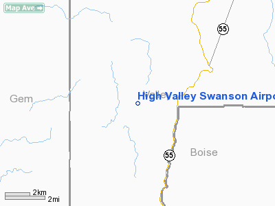
High Valley Swanson Airport |
|
|
Location
& QuickFacts
|
FAA
Information Effective: |
2007-07-05 |
|
Airport
Identifier: |
ID35 |
|
Airport
Status: |
Operational |
|
Longitude/Latitude: |
116-08-36.4720W/44-14-20.6090N
-116.143464/44.239058 (Estimated) |
|
Elevation: |
4883 ft / 1488.34 m (Surveyed) |
|
Land: |
7 acres |
|
From
nearest city: |
18 nautical miles SW of Cascade, ID |
|
Location: |
Valley County, ID |
|
Magnetic Variation: |
17E (1985) |
Owner
& Manager
|
Ownership: |
Privately
owned |
|
Owner: |
Larry Swanson |
|
Address: |
C/o Billy Jeffs, 660 High Valley Road
Cascade, ID 83611 |
|
Phone
number: |
208-830-6470 |
|
Manager: |
Larry Swanson |
|
Address: |
C/o Billy Jeffs, 660 High Valley Road
Cascade, ID 83611 |
|
Phone number: |
208-830-6470 |
Airport Operations and Facilities
|
Airport
Use: |
Private |
|
Wind
indicator: |
Yes |
|
Segmented Circle: |
No |
|
Control
Tower: |
No |
|
Landing
fee charge: |
No |
|
Sectional chart: |
Salt Lake City |
|
Region: |
ANM - Northwest Mountain |
|
Boundary
ARTCC: |
ZLC - Salt Lake City |
|
Tie-in
FSS: |
BOI - Boise |
|
FSS
on Airport: |
No |
|
FSS
Phone: |
208-332-0200 |
|
FSS
Toll Free: |
1-800-WX-BRIEF |
|
Runway Information
Runway 18/36
|
Dimension: |
2300
x 50 ft / 701.0 x 15.2 m |
|
Surface: |
TURF-DIRT, |
|
|
Runway 18 |
Runway 36 |
|
Traffic
Pattern: |
Left |
Left |
|
Radio Navigation
Aids
|
ID |
Type |
Name |
Ch |
Freq |
Var |
Dist |
|
IOM |
NDB |
Mc Call |
|
363.00 |
17E |
34.1 nm |
|
BO |
NDB |
Ustik |
|
359.00 |
17E |
39.3 nm |
|
ONO |
NDB |
Ontario |
|
305.00 |
17E |
39.6 nm |
|
MPA |
NDB |
Meridian |
|
238.00 |
16E |
41.9 nm |
|
DNJ |
VORTAC |
Donnelly |
109X |
116.20 |
19E |
31.9 nm |
|
BOI |
VORTAC |
Boise |
080X |
113.30 |
17E |
41.3 nm |
|
BOI |
VOT |
Boise |
|
116.70 |
|
40.3 nm |
Remarks
- CAUTION:
RWY 18/36 TREES AND BIRD HAZARD ON RWY 18.
Based
Aircraft
|
Aircraft
based on field: |
1 |
|
Single
Engine Airplanes: |
1 |
High Valley Swanson Airport
Address:
Valley County, ID
Tel:
208-830-6470
Images
and information placed above are from
http://www.airport-data.com/airport/ID35/
We
thank them for the data!
| General
Info |
| Country |
United
States |
| State |
IDAHO
|
| FAA ID |
ID35 |
| Latitude |
44-14-20.609N
|
| Longitude |
116-08-36.472W
|
| Elevation |
4883 feet
|
| Near City |
CASCADE
|
We don't guarantee the information is fresh and accurate. The data may
be wrong or outdated.
For more up-to-date information please refer to other sources.
|
|


