 |
|
Location
& QuickFacts
|
FAA
Information Effective: |
2007-07-05 |
|
Airport
Identifier: |
3ID4 |
|
Airport
Status: |
Operational |
|
Longitude/Latitude: |
115-18-19.2500W/42-57-14.6300N
-115.305347/42.954064 (Estimated) |
|
Elevation: |
2560 ft / 780.29 m (Estimated) |
|
Land: |
0 acres |
|
From
nearest city: |
2 nautical miles SW of Glenns Ferry, ID |
|
Location: |
Elmore County, ID |
|
Magnetic Variation: |
() |
Owner
& Manager
|
Ownership: |
Privately
owned |
|
Owner: |
Glenns Ferry Health Center, Inc. |
|
Address: |
Po Box 266, 468 West First Avenue
Glenns Ferry, ID 83623 |
|
Phone
number: |
208-366-7416 |
|
Manager: |
Leslyn Phelps
CHIEF EXECUTIVE OFFICER |
|
Address: |
Po Box 266, 468 West First Avenue
Glenns Ferry, ID 83623 |
|
Phone number: |
208-366-7416 |
Airport Operations and Facilities
|
Airport
Use: |
Private |
|
Wind
indicator: |
Yes |
|
Segmented Circle: |
No |
|
Control
Tower: |
No |
|
Sectional chart: |
Salt Lake City |
|
Region: |
ANM - Northwest Mountain |
|
Boundary
ARTCC: |
ZLC - Salt Lake City |
|
Tie-in
FSS: |
BOI - Boise |
|
FSS
Phone: |
208-332-0200 |
|
FSS
Toll Free: |
1-800-WX-BRIEF |
|
Runway Information
Helipad H1
|
Dimension: |
40
x 40 ft / 12.2 x 12.2 m |
|
Surface: |
TURF, |
|
|
Runway H1 |
Runway |
|
Traffic
Pattern: |
Left |
Left |
|
Radio Navigation
Aids
|
ID |
Type |
Name |
Ch |
Freq |
Var |
Dist |
|
STI |
NDB |
Sturgeon |
|
333.00 |
17E |
18.2 nm |
|
HDG |
NDB |
Steelhead |
|
211.00 |
16E |
27.9 nm |
|
MUO |
TACAN |
Mountain Home |
087X |
|
18E |
25.6 nm |
|
LIA |
VOR |
Liberator |
|
114.90 |
18E |
20.7 nm |
|
TWF |
VORTAC |
Twin Falls |
105X |
115.80 |
18E |
45.9 nm |
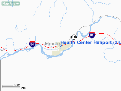
Health Center Heliport
Address:
Elmore County, ID
Tel:
208-366-7416
Images
and information placed above are from
http://www.airport-data.com/airport/3ID4/
We
thank them for the data!
We don't guarantee the information is fresh and accurate. The data may
be wrong or outdated.
For more up-to-date information please refer to other sources.
|
|


