 |
|
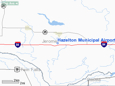
Hazelton Municipal Airport |
|
|
Location
& QuickFacts
|
FAA
Information Effective: |
2007-07-05 |
|
Airport
Identifier: |
U94 |
|
Airport
Status: |
Operational |
|
Longitude/Latitude: |
114-08-18.1030W/42-34-44.6820N
-114.138362/42.579078 (Estimated) |
|
Elevation: |
4172 ft / 1271.63 m (Surveyed) |
|
Land: |
57 acres |
|
From
nearest city: |
1 nautical miles S of Hazelton, ID |
|
Location: |
Jerome County, ID |
|
Magnetic Variation: |
16E (1985) |
Owner
& Manager
|
Ownership: |
Publicly
owned |
|
Owner: |
Jerome County |
|
Address: |
300 N Lincoln, Suite 301
Jerome, ID 83338 |
|
Phone number: |
208-324-8811 |
|
Manager: |
Bonnie Deitrick |
|
Address: |
472 Hwy 25
Jerome, ID 83338 |
|
Phone number: |
208-324-9980 |
Airport
Operations and Facilities
|
Airport
Use: |
Open
to public |
|
Wind
indicator: |
Yes |
|
Segmented Circle: |
No |
|
Control
Tower: |
No |
|
Landing
fee charge: |
No |
|
Sectional chart: |
Salt Lake City |
|
Region: |
ANM - Northwest Mountain |
|
Boundary
ARTCC: |
ZLC - Salt Lake City |
|
Tie-in
FSS: |
BOI - Boise |
|
FSS
on Airport: |
No |
|
FSS
Phone: |
208-332-0200 |
|
FSS
Toll Free: |
1-800-WX-BRIEF |
|
NOTAMs
Facility: |
BOI (NOTAM-d service avaliable) |
|
Federal Agreements: |
1 |
Airport Communications
Airport Services
|
Airframe
Repair: |
NONE |
|
Power
Plant Repair: |
NONE |
|
Bottled
Oxygen: |
NONE |
|
Bulk
Oxygen: |
NONE |
|
Runway Information
Runway 06/24
|
Dimension: |
2800 x 90 ft / 853.4 x 27.4 m
HAS A 300 FT GRVL STOPWAY ON NE END. |
|
Surface: |
GRVL, Good Condition |
|
|
Runway 06 |
Runway 24 |
|
Traffic
Pattern: |
Left |
Left |
|
Obstruction: |
10 ft road |
12 ft tank, 75.0 ft from runway, 90 ft left
of centerline, 6:1 slope to clear |
|
Radio Navigation
Aids
|
ID |
Type |
Name |
Ch |
Freq |
Var |
Dist |
|
HDG |
NDB |
Steelhead |
|
211.00 |
16E |
31.1 nm |
|
HLE |
NDB/DME |
Hailey |
025X |
220.00 |
16E |
45.3 nm |
|
BYI |
VOR/DME |
Burley |
088X |
114.10 |
18E |
12.1 nm |
|
TWF |
VORTAC |
Twin Falls |
105X |
115.80 |
18E |
16.7 nm |
Remarks
- NO
WINTER MAINT.
- RWY
06/24 NO LINE OF SIGHT BTN RWY ENDS.
- ARPT
USED PRIMARILY FOR AG OPERATIONS.
- ESTABD
PRIOR TO 15 MAY 1959.
Based
Aircraft
|
Aircraft
based on field: |
5 |
|
Single
Engine Airplanes: |
5 |
Operational Statistics
Time Period: 2006-04-27
- 2007-04-26
|
Aircraft
Operations: |
56/Week |
|
General
Aviation Local: |
89.7% |
|
General
Aviation Itinerant: |
10.3% |
Hazelton Municipal Airport
Address:
Jerome County, ID
Tel:
208-324-8811, 208-324-9980
Images
and information placed above are from
http://www.airport-data.com/airport/U94/
We
thank them for the data!
| General
Info |
| Country |
United
States |
| State |
IDAHO
|
| FAA ID |
U94 |
| Latitude |
42-34-44.682N
|
| Longitude |
114-08-18.103W
|
| Elevation |
4172 feet
|
| Near City |
HAZELTON
|
We don't guarantee the information is fresh and accurate. The data may
be wrong or outdated.
For more up-to-date information please refer to other sources.
|
|


