 |
|
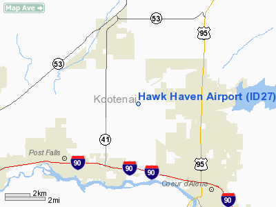
Location
& QuickFacts
|
FAA
Information Effective: |
2007-07-05 |
|
Airport
Identifier: |
ID27 |
|
Airport
Status: |
Operational |
|
Longitude/Latitude: |
116-51-33.7000W/47-45-19.6530N
-116.859361/47.755459 (Estimated) |
|
Elevation: |
2333 ft / 711.10 m (Estimated) |
|
Land: |
10 acres |
|
From
nearest city: |
5 nautical miles SE of Coeur D Alene, ID |
|
Location: |
Kootenai County, ID |
|
Magnetic Variation: |
19E (1985) |
Owner
& Manager
|
Ownership: |
Privately
owned |
|
Owner: |
Douglas Wayne Colley |
|
Address: |
S 7177 Hawk Haven Ct
Rathdrum, ID 83858 |
|
Manager: |
Douglas Wayne Colley |
|
Address: |
803 Nw 4th
Pendleton, OR 97801 |
Airport Operations and Facilities
|
Airport Use: |
Private
PERSONAL USE. |
|
Segmented Circle: |
No |
|
Control Tower: |
No |
|
Sectional chart: |
Great Falls |
|
Region: |
ANM - Northwest Mountain |
|
Traffic Pattern Alt: |
2800 ft |
|
Boundary ARTCC: |
ZSE - Seattle |
|
Tie-in FSS: |
BOI - Boise |
|
FSS on Airport: |
No |
|
FSS Phone: |
208-332-0200 |
|
FSS Toll Free: |
1-800-WX-BRIEF |
Airport
Communications
|
Runway Information
Runway 02/20
|
Dimension: |
800
x 30 ft / 243.8 x 9.1 m |
|
Surface: |
TURF, |
|
|
Runway 02 |
Runway 20 |
|
Traffic
Pattern: |
Right |
Left |
|
Obstruction: |
60 ft pole, 500.0 ft from runway |
|
|
Radio Navigation
Aids
|
ID |
Type |
Name |
Ch |
Freq |
Var |
Dist |
|
SFF |
NDB |
Felts |
|
365.00 |
19E |
18.8 nm |
|
DPY |
NDB |
Deer Park |
|
216.00 |
19E |
26.2 nm |
|
SZT |
NDB |
Sandpoe |
|
264.00 |
20E |
34.3 nm |
|
SKA |
TACAN |
Fairchild |
051X |
|
19E |
33.6 nm |
|
COE |
VOR/DME |
Coeur D'alene |
025X |
108.80 |
19E |
1.9 nm |
|
GEG |
VORTAC |
Spokane |
102X |
115.50 |
21E |
33.1 nm |
|
SFF |
VOT |
Spokane/felts Field |
|
114.00 |
|
19.2 nm |
|
GEG |
VOT |
Spokane Intl |
|
109.60 |
|
28.7 nm |
Remarks
- OPNS
TO BE CONDUCTED WITH COUER D'ALENE TWR (FREQ 119.1) WHEN TWR OPNL.
- INGRESS:
RY 02 PREFERRED RY FOR NOISE ABATEMENT; EGRESS: RY 20 PREFERRED RY FOR
NOISE ABATEMENT.
Based
Aircraft
|
Aircraft
based on field: |
2 |
|
Single
Engine Airplanes: |
1 |
|
Ultralights: |
1 |
Hawk Haven Airport
Address:
Kootenai County, ID
Tel:
Images
and information placed above are from
http://www.airport-data.com/airport/ID27/
We
thank them for the data!
| General
Info |
| Country |
United
States |
| State |
IDAHO
|
| FAA ID |
ID27 |
| Latitude |
47-45-19.653N
|
| Longitude |
116-51-33.700W
|
| Elevation |
2333 feet
|
| Near City |
COUER
D'ALENE |
We don't guarantee the information is fresh and accurate. The data may
be wrong or outdated.
For more up-to-date information please refer to other sources.
|
|


