 |
|
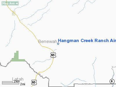
Hangman Creek Ranch Airport |
Location
& QuickFacts
|
FAA
Information Effective: |
2007-07-05 |
|
Airport
Identifier: |
ID97 |
|
Airport
Status: |
Operational |
|
Longitude/Latitude: |
116-48-40.5900W/47-06-25.6300N
-116.811275/47.107119 (Estimated) |
|
Elevation: |
2635 ft / 803.15 m (Estimated) |
|
Land: |
137 acres |
|
From
nearest city: |
5 nautical miles NW of De Smet, ID |
|
Location: |
Benewah County, ID |
|
Magnetic Variation: |
18E (1995) |
Owner
& Manager
|
Ownership: |
Privately
owned |
|
Owner: |
Hanman Creek Ranch, Llc |
|
Address: |
308 Toland Road
De Smet, ID 83824 |
|
Phone
number: |
760-458-0138 |
|
Manager: |
Laughlin Mckinnon
OR CONTACT DAVID HANST - 775-721-3560. |
|
Address: |
308 Toland Road
De Smet, ID 83824 |
|
Phone number: |
760-458-0138 |
Airport Operations and Facilities
|
Airport
Use: |
Private |
|
Wind
indicator: |
Yes |
|
Segmented Circle: |
No |
|
Control
Tower: |
No |
|
Sectional chart: |
Great Falls |
|
Region: |
ANM - Northwest Mountain |
|
Boundary
ARTCC: |
ZSE - Seattle |
|
Tie-in
FSS: |
BOI - Boise |
|
FSS
Phone: |
208-332-0200 |
|
FSS
Toll Free: |
1-800-WX-BRIEF |
|
Runway Information
Runway 11/29
|
Dimension: |
2100
x 60 ft / 640.1 x 18.3 m |
|
Surface: |
TURF-GRVL, |
|
|
Runway 11 |
Runway 29 |
|
Traffic
Pattern: |
Left |
Left |
|
Obstruction: |
|
25 ft trees, 700.0 ft from runway |
|
Radio Navigation
Aids
|
ID |
Type |
Name |
Ch |
Freq |
Var |
Dist |
|
SFF |
NDB |
Felts |
|
365.00 |
19E |
40.3 nm |
|
SKA |
TACAN |
Fairchild |
051X |
|
19E |
46.0 nm |
|
PUW |
VOR/DME |
Pullman |
027X |
109.00 |
20E |
31.0 nm |
|
COE |
VOR/DME |
Coeur D'alene |
025X |
108.80 |
19E |
40.1 nm |
|
MQG |
VOR/DME |
Nez Perce |
019X |
108.20 |
20E |
43.7 nm |
|
GEG |
VORTAC |
Spokane |
102X |
115.50 |
21E |
43.1 nm |
|
SFF |
VOT |
Spokane/felts Field |
|
114.00 |
|
40.2 nm |
|
GEG |
VOT |
Spokane Intl |
|
109.60 |
|
42.9 nm |
Remarks
Based
Aircraft
|
Aircraft
based on field: |
1 |
|
Single
Engine Airplanes: |
1 |
Hangman Creek Ranch Airport
Address:
Benewah County, ID
Tel:
760-458-0138
Images
and information placed above are from
http://www.airport-data.com/airport/ID97/
We
thank them for the data!
| General
Info |
| Country |
United
States |
| State |
IDAHO
|
| FAA ID |
ID97 |
| Latitude |
47-06-25.630N
|
| Longitude |
116-48-40.590W
|
| Elevation |
2635 feet
|
| Near City |
DE SMET
|
We don't guarantee the information is fresh and accurate. The data may
be wrong or outdated.
For more up-to-date information please refer to other sources.
|
|


