 |
|
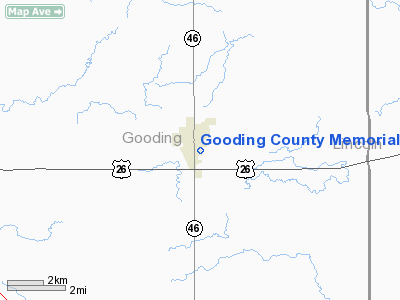
Gooding County Memorial Hospital Heliport |
|
|
Location
& QuickFacts
|
FAA
Information Effective: |
2007-07-05 |
|
Airport
Identifier: |
1ID8 |
|
Airport
Status: |
Operational |
|
Longitude/Latitude: |
114-42-30.0000W/42-56-00.0000N
-114.708333/42.933333 (Estimated) |
|
Elevation: |
3600 ft / 1097.28 m (Estimated) |
|
Land: |
0 acres |
|
From
nearest city: |
0 nautical miles N of Gooding, ID |
|
Location: |
Gooding County, ID |
|
Magnetic Variation: |
15E (2000) |
Owner
& Manager
|
Ownership: |
Publicly
owned |
|
Owner: |
Gooding County Meml Hosp District |
|
Address: |
1120 Montana St.
Gooding, ID 83330 |
|
Phone
number: |
208-934-4433 |
|
Manager: |
James P. Henshaw, Hospital Ceo |
|
Address: |
1120 Montana St. P.o. Box 418
Gooding, ID 83330 |
|
Phone number: |
208-934-4433 |
Airport Operations and Facilities
|
Airport
Use: |
Private |
|
Wind
indicator: |
Yes |
|
Segmented Circle: |
No |
|
Control
Tower: |
No |
|
Lighting
Schedule: |
PHONE REQ |
|
Sectional chart: |
Salt Lake City |
|
Region: |
ANM - Northwest Mountain |
|
Boundary
ARTCC: |
ZLC - Salt Lake City |
|
Tie-in
FSS: |
BOI - Boise |
|
FSS
Phone: |
208-332-0200 |
|
FSS
Toll Free: |
1-800-WX-BRIEF |
|
Runway Information
Helipad H1
|
Dimension: |
30
x 30 ft / 9.1 x 9.1 m |
|
Surface: |
CONC, |
|
|
Runway H1 |
Runway |
|
Traffic
Pattern: |
Left |
Left |
|
Radio Navigation
Aids
|
ID |
Type |
Name |
Ch |
Freq |
Var |
Dist |
|
HDG |
NDB |
Steelhead |
|
211.00 |
16E |
1.8 nm |
|
STI |
NDB |
Sturgeon |
|
333.00 |
17E |
43.1 nm |
|
HLE |
NDB/DME |
Hailey |
025X |
220.00 |
16E |
31.4 nm |
|
LIA |
VOR |
Liberator |
|
114.90 |
18E |
47.0 nm |
|
BYI |
VOR/DME |
Burley |
088X |
114.10 |
18E |
42.8 nm |
|
TWF |
VORTAC |
Twin Falls |
105X |
115.80 |
18E |
28.9 nm |
Gooding County Memorial Hospital Heliport
Address:
Gooding County, ID
Tel:
208-934-4433
Images
and information placed above are from
http://www.airport-data.com/airport/1ID8/
We
thank them for the data!
| General
Info |
| Country |
United
States |
| State |
IDAHO
|
| FAA ID |
1ID8 |
| Latitude |
42-56-00.000N
|
| Longitude |
114-42-30.000W
|
| Elevation |
3600 feet
|
| Near City |
GOODING
|
We don't guarantee the information is fresh and accurate. The data may
be wrong or outdated.
For more up-to-date information please refer to other sources.
|
|


