 |
|
|
|
|
|
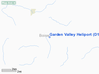
Location
& QuickFacts
|
FAA
Information Effective: |
2007-07-05 |
|
Airport
Identifier: |
D12 |
|
Airport
Status: |
Operational |
|
Longitude/Latitude: |
115-55-33.4240W/44-03-51.6190N
-115.925951/44.064339 (Estimated) |
|
Elevation: |
3150 ft / 960.12 m (Estimated) |
|
Land: |
3 acres |
|
From
nearest city: |
2 nautical miles SE of Garden Valley, ID |
|
Location: |
Boise County, ID |
|
Magnetic Variation: |
17E (1985) |
Owner & Manager
|
Ownership: |
Publicly owned |
|
Owner: |
Boise National Forest |
|
Address: |
918 Commerce Street
Boise, ID 83705 |
|
Phone number: |
208-334-9851
FTS 554-9851. |
|
Manager: |
Herb Corn - Air Officer |
|
Address: |
1918 Commerce Avenue
Boise, ID 83702 |
|
Phone number: |
208-334-9800 |
Airport Operations and Facilities
|
Airport Use: |
Private |
|
Wind indicator: |
Yes |
|
Segmented Circle: |
No |
|
Control Tower: |
No |
|
Landing fee charge: |
No |
|
Sectional chart: |
Salt Lake City |
|
Region: |
ANM - Northwest Mountain |
|
Boundary ARTCC: |
ZLC - Salt Lake City |
|
Tie-in FSS: |
BOI - Boise |
|
FSS on Airport: |
No |
|
FSS Phone: |
208-332-0200 |
|
FSS Toll Free: |
1-800-WX-BRIEF |
Airport Services
|
Fuel
available: |
A |
|
Airframe
Repair: |
NONE |
|
Power
Plant Repair: |
NONE |
|
Bottled
Oxygen: |
NONE |
|
Bulk
Oxygen: |
NONE |
|
Runway Information
Helipad H1
|
Dimension: |
22
x 18 ft / 6.7 x 5.5 m |
|
Surface: |
CONC, |
|
|
Runway H1 |
Runway |
|
Traffic
Pattern: |
Left |
Left |
|
Obstruction: |
1000 ft hill, 2000.0 ft from runway, 2:1 slope
to clear |
|
|
Helipad H2
|
Dimension: |
20
x 20 ft / 6.1 x 6.1 m |
|
Surface: |
CONC, |
|
|
Runway H2 |
Runway |
|
Traffic
Pattern: |
Left |
Left |
|
Obstruction: |
1000 ft hill, 2000.0 ft from runway, 2:1 slope
to clear |
|
|
Radio Navigation
Aids
|
ID |
Type |
Name |
Ch |
Freq |
Var |
Dist |
|
BO |
NDB |
Ustik |
|
359.00 |
17E |
32.8 nm |
|
MPA |
NDB |
Meridian |
|
238.00 |
16E |
38.4 nm |
|
IOM |
NDB |
Mc Call |
|
363.00 |
17E |
45.2 nm |
|
ONO |
NDB |
Ontario |
|
305.00 |
17E |
46.8 nm |
|
BOI |
VORTAC |
Boise |
080X |
113.30 |
17E |
32.8 nm |
|
DNJ |
VORTAC |
Donnelly |
109X |
116.20 |
19E |
43.9 nm |
|
BOI |
VOT |
Boise |
|
116.70 |
|
32.5 nm |
Remarks
- CAUTION:
HELIPORT LCTD ADJACENT TO GARDEN VALLEY ARPT.
Based
Aircraft
|
Aircraft
based on field: |
1 |
|
Helicopters: |
1
1-5 SUMMER MONTHS. |
Operational Statistics
Time Period: 1982-06-17
- 1983-06-16
|
Aircraft
Operations: |
20/Week |
|
General
Aviation Local: |
100.0% |
Garden Valley Heliport
Address:
Boise County, ID
Tel:
208-334-9851, 208-334-9800
Images
and information placed above are from
http://www.airport-data.com/airport/D12/
We
thank them for the data!
| General
Info |
| Country |
United
States |
| State |
IDAHO
|
| FAA ID |
D12 |
| Latitude |
44-03-51.619N
|
| Longitude |
115-55-33.424W
|
| Elevation |
3150 feet
|
| Near City |
GARDEN
VALLEY |
We don't guarantee the information is fresh and accurate. The data may
be wrong or outdated.
For more up-to-date information please refer to other sources.
|
|


