 |
|
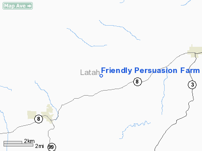
Friendly Persuasion Farm Airport |
Location
& QuickFacts
|
FAA
Information Effective: |
2007-07-05 |
|
Airport
Identifier: |
ID94 |
|
Airport
Status: |
Operational |
|
Longitude/Latitude: |
116-41-29.0000W/46-46-36.0000N
-116.691389/46.776667 (Estimated) |
|
Elevation: |
2860 ft / 871.73 m (Estimated) |
|
Land: |
40 acres |
|
From
nearest city: |
5 nautical miles NE of Troy, ID |
|
Location: |
Latah County, ID |
|
Magnetic Variation: |
17E (2000) |
Owner
& Manager
|
Ownership: |
Privately
owned |
|
Owner: |
Duricka Family Trust |
|
Address: |
1061 White Pine Flats Rd.
Troy, ID 83871 |
|
Phone
number: |
208-835-5083 |
|
Manager: |
Richard Duricka |
|
Address: |
1061 White Pine Flats Rd.
Troy, ID 83871 |
|
Phone number: |
208-835-5083 |
Airport Operations and Facilities
|
Airport
Use: |
Private |
|
Segmented Circle: |
No |
|
Control
Tower: |
No |
|
Sectional chart: |
Great Falls |
|
Region: |
ANM - Northwest Mountain |
|
Boundary
ARTCC: |
ZSE - Seattle |
|
Tie-in
FSS: |
BOI - Boise |
|
FSS
Phone: |
208-332-0200 |
|
FSS
Toll Free: |
1-800-WX-BRIEF |
|
Runway Information
Runway 06/24
|
Dimension: |
1600
x 40 ft / 487.7 x 12.2 m |
|
Surface: |
TURF, |
|
|
Runway 06 |
Runway 24 |
|
Traffic
Pattern: |
Left |
Left |
|
Radio Navigation
Aids
|
ID |
Type |
Name |
Ch |
Freq |
Var |
Dist |
|
PUW |
VOR/DME |
Pullman |
027X |
109.00 |
20E |
22.8 nm |
|
MQG |
VOR/DME |
Nez Perce |
019X |
108.20 |
20E |
24.9 nm |
Based
Aircraft
|
Aircraft
based on field: |
2 |
|
Single
Engine Airplanes: |
2 |
Friendly Persuasion Farm Airport
Address:
Latah County, ID
Tel:
208-835-5083
Images
and information placed above are from
http://www.airport-data.com/airport/ID94/
We
thank them for the data!
| General
Info |
| Country |
United
States |
| State |
IDAHO
|
| FAA ID |
ID94 |
| Latitude |
46-46-36.000N
|
| Longitude |
116-41-29.000W
|
| Elevation |
2860 feet
|
| Near City |
TROY |
We don't guarantee the information is fresh and accurate. The data may
be wrong or outdated.
For more up-to-date information please refer to other sources.
|
|


