 |
|
|
|
|
|
Location
& QuickFacts
|
FAA
Information Effective: |
2007-07-05 |
|
Airport
Identifier: |
03ID |
|
Airport
Status: |
Operational |
|
Longitude/Latitude: |
116-31-57.5270W/44-47-39.5860N
-116.532646/44.794329 (Estimated) |
|
Elevation: |
3180 ft / 969.26 m (Estimated) |
|
Land: |
0 acres |
|
From
nearest city: |
6 nautical miles NW of Council, ID |
|
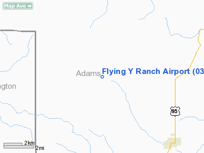
Location: |
Adams County, ID |
|
Magnetic Variation: |
18E (1985) |
Owner
& Manager
|
Ownership: |
Privately
owned |
|
Owner: |
Brett Armacost |
|
Address: |
P.o. Box 179
Oxbow, OR 97840 |
|
Phone
number: |
208-867-1456 |
|
Manager: |
Brett Armacost |
|
Address: |
P.o. Box 179
Oxbow, OR 97840 |
|
Phone number: |
208-867-1456 |
Airport Operations and Facilities
|
Airport Use: |
Private |
|
Wind indicator: |
Yes |
|
Segmented Circle: |
No |
|
Control Tower: |
No |
|
Landing fee charge: |
No |
|
Sectional chart: |
Great Falls |
|
Region: |
ANM - Northwest Mountain |
|
Boundary ARTCC: |
ZLC - Salt Lake City |
|
Tie-in FSS: |
BOI - Boise |
|
FSS on Airport: |
No |
|
FSS Phone: |
208-332-0200 |
|
FSS Toll Free: |
1-800-WX-BRIEF |
Airport
Communications
Airport
Services
|
Airframe
Repair: |
NONE |
|
Power
Plant Repair: |
NONE |
|
Runway Information
Runway 11/29
|
Dimension: |
1800
x 100 ft / 548.6 x 30.5 m |
|
Surface: |
TURF, |
|
|
Runway 11 |
Runway 29 |
|
Traffic
Pattern: |
Left |
Right |
|
Obstruction: |
75 ft trees, 2680.0 ft from runway |
300 ft hills, 2680.0 ft from runway |
|
Radio Navigation
Aids
|
ID |
Type |
Name |
Ch |
Freq |
Var |
Dist |
|
IOM |
NDB |
Mc Call |
|
363.00 |
17E |
18.4 nm |
|
DNJ |
VORTAC |
Donnelly |
109X |
116.20 |
19E |
14.0 nm |
Remarks
- ANIMALS
MAY BE ON RWY.
- CLSD
IN WINTER--NO SNOW REMOVAL.
- FILED
FOR RECORD PURPOSES ONLY.
Based
Aircraft
|
Aircraft
based on field: |
2 |
|
Single
Engine Airplanes: |
2 |
Flying Y Ranch Airport
Address:
Adams County, ID
Tel:
208-867-1456
Images
and information placed above are from
http://www.airport-data.com/airport/03ID/
We
thank them for the data!
| General
Info |
| Country |
United
States |
| State |
IDAHO
|
| FAA ID |
03ID |
| Latitude |
44-47-39.586N
|
| Longitude |
116-31-57.527W
|
| Elevation |
3180 feet
|
| Near City |
COUNCIL
|
We don't guarantee the information is fresh and accurate. The data may
be wrong or outdated.
For more up-to-date information please refer to other sources.
|
|


