 |
|
Location
& QuickFacts
|
FAA
Information Effective: |
2007-07-05 |
|
Airport
Identifier: |
ID30 |
|
Airport
Status: |
Operational |
|
Longitude/Latitude: |
114-24-23.1730W/43-46-19.6670N
-114.406437/43.772130 (Estimated) |
|
Elevation: |
6165 ft / 1879.09 m (Estimated) |
|
Land: |
1 acres |
|
From
nearest city: |
5 nautical miles SE of Ketchum, ID |
|
Location: |
Blaine County, ID |
|
Magnetic Variation: |
16E (1990) |
Owner & Manager
|
Ownership: |
Privately owned |
|
Owner: |
Frank E Everett |
|
Address: |
Po Box 3555
Ketchum, ID 83340 |
|
Phone number: |
208-726-2727 |
|
Manager: |
Frank E Everett |
|
Address: |
Po Box 3555
Ketchum, ID 83340 |
|
Phone number: |
208-726-2727 |
Airport
Operations and Facilities
|
Airport
Use: |
Private |
|
Wind
indicator: |
Yes |
|
Segmented Circle: |
No |
|
Control
Tower: |
No |
|
Sectional chart: |
Salt Lake City |
|
Region: |
ANM - Northwest Mountain |
|
Boundary
ARTCC: |
ZLC - Salt Lake City |
|
Tie-in
FSS: |
BOI - Boise |
|
FSS
Phone: |
208-332-0200 |
|
FSS
Toll Free: |
1-800-WX-BRIEF |
|
Runway Information
Helipad H1
|
Dimension: |
60
x 60 ft / 18.3 x 18.3 m |
|
Surface: |
CONC, |
|
|
Runway H1 |
Runway |
|
Traffic
Pattern: |
Left |
Left |
|
Radio Navigation
Aids
|
ID |
Type |
Name |
Ch |
Freq |
Var |
Dist |
|
LLJ |
NDB |
Challis |
|
397.00 |
17E |
45.7 nm |
|
AOC |
NDB |
Arco |
|
200.00 |
15E |
47.4 nm |
|
HLE |
NDB/DME |
Hailey |
025X |
220.00 |
16E |
27.6 nm |
Based
Aircraft
|
Aircraft
based on field: |
1 |
|
Helicopters: |
1 |
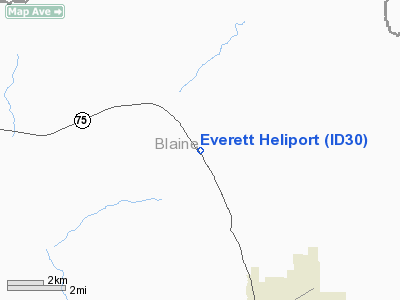
Everett Heliport
Address:
Blaine County, ID
Tel:
208-726-2727
Images
and information placed above are from
http://www.airport-data.com/airport/ID30/
We
thank them for the data!
| General
Info |
| Country |
United
States |
| State |
IDAHO
|
| FAA ID |
ID30 |
| Latitude |
43-46-19.667N
|
| Longitude |
114-24-23.173W
|
| Elevation |
6165 feet
|
| Near City |
KETCHUM
|
We don't guarantee the information is fresh and accurate. The data may
be wrong or outdated.
For more up-to-date information please refer to other sources.
|
|


