 |
|
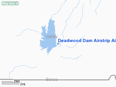
Deadwood Dam Airstrip Airport |
|
|
Location
& QuickFacts
|
FAA
Information Effective: |
2007-07-05 |
|
Airport
Identifier: |
ID86 |
|
Airport
Status: |
Operational |
|
Longitude/Latitude: |
115-38-29.0000W/44-17-52.0000N
-115.641389/44.297778 (Estimated) |
|
Elevation: |
5489 ft / 1673.05 m (Estimated) |
|
Land: |
0 acres |
|
From
nearest city: |
22 nautical miles SE of Cascade, ID |
|
Location: |
Valley County, ID |
|
Magnetic Variation: |
17E (1985) |
Owner & Manager
|
Ownership: |
Publicly owned |
|
Owner: |
Us Bureau Of Reclamation |
|
Address: |
214 Broadway Ave.
Boise, ID 83702 |
|
Phone number: |
208-378-5120 |
|
Manager: |
Jerrold Gregg |
|
Address: |
214 Broadway Ave
Boise, ID 83702 |
|
Phone number: |
208-334-1460
EXT 2460. |
Airport Operations and Facilities
|
Airport Use: |
Private |
|
Wind indicator: |
Yes |
|
Segmented Circle: |
No |
|
Control Tower: |
No |
|
Landing fee charge: |
No |
|
Sectional chart: |
Salt Lake City |
|
Region: |
ANM - Northwest Mountain |
|
Boundary ARTCC: |
ZLC - Salt Lake City |
|
Tie-in FSS: |
BOI - Boise |
|
FSS on Airport: |
No |
|
FSS Phone: |
208-332-0200 |
|
FSS Toll Free: |
1-800-WX-BRIEF |
Airport Services
|
Airframe
Repair: |
NONE |
|
Power
Plant Repair: |
NONE |
|
Runway
Information
Runway NE/SW
|
Dimension: |
1800
x 50 ft / 548.6 x 15.2 m |
|
Surface: |
DIRT, |
|
|
Runway NE |
Runway SW |
|
Traffic
Pattern: |
Left |
Left |
|
Radio Navigation
Aids
|
ID |
Type |
Name |
Ch |
Freq |
Var |
Dist |
|
IOM |
NDB |
Mc Call |
|
363.00 |
17E |
36.4 nm |
|
DNJ |
VORTAC |
Donnelly |
109X |
116.20 |
19E |
37.2 nm |
Remarks
- HIGH
RIDGE AT E END.
- RWY
HAS 6 PER CENT GRADE SLOPING DOWN E TO W.
- ONE
WAY LANDING FM W TO E. TKOF E TO W.
- FIELD
IS MAINTAINED FOR GOVT USE ONLY BY THE U.S. FOREST SERVICE.
- DEEP
WINTER SNOW IS NOT PLOWED.
- ONLY
LIGHT PLANES, PILOTED BY EXPERIENCED PILOTS, SHOULD ATTEMPT TO USE ARPT.
- ESTABD
PRIOR TO 12/31/58.
Deadwood Dam Airstrip Airport
Address:
Valley County, ID
Tel:
208-378-5120, 208-334-1460
Images
and information placed above are from
http://www.airport-data.com/airport/ID86/
We
thank them for the data!
| General
Info |
| Country |
United
States |
| State |
IDAHO
|
| FAA ID |
ID86 |
| Latitude |
44-17-52.000N
|
| Longitude |
115-38-29.000W
|
| Elevation |
5489 feet
|
| Near City |
CASCADE
|
We don't guarantee the information is fresh and accurate. The data may
be wrong or outdated.
For more up-to-date information please refer to other sources.
|
|


