 |
|
Location
& QuickFacts
|
FAA
Information Effective: |
2007-07-05 |
|
Airport
Identifier: |
7GE1 |
|
Airport
Status: |
Closed Permanently |
|
Longitude/Latitude: |
116-45-03.5040W/43-39-29.5750N
-116.750973/43.658215 (Estimated) |
|
Elevation: |
2370 ft / 722.38 m (Estimated) |
|
Land: |
0 acres |
|
From
nearest city: |
2 nautical miles W of Caldwell, ID |
|
Location: |
Canyon County, ID |
|
Magnetic Variation: |
17E (1985) |
Owner & Manager
|
Ownership: |
Privately owned |
|
Owner: |
Grace Davison |
|
Address: |
Box 201
Caldwell, ID 83605 |
|
Manager: |
Grace Davison |
|
Address: |
Box 201
Caldwell, ID 83605 |
|
Phone number: |
208-459-1266 |
Airport Operations and Facilities
|
Airport Use: |
Private |
|
Wind indicator: |
Yes |
|
Segmented Circle: |
No |
|
Control Tower: |
No |
|
Landing fee charge: |
No |
|
Sectional chart: |
Salt Lake City |
|
Region: |
ANM - Northwest Mountain |
|
Boundary ARTCC: |
ZLC - Salt Lake City |
|
Tie-in FSS: |
BOI - Boise |
|
FSS on Airport: |
No |
|
FSS Phone: |
208-332-0200 |
|
FSS Toll Free: |
1-800-WX-BRIEF |
Airport Services
|
Airframe
Repair: |
NONE |
|
Power
Plant Repair: |
NONE |
|
Runway Information
Runway 10/28
|
Dimension: |
2500
x 100 ft / 762.0 x 30.5 m |
|
Surface: |
TURF, |
|
|
Runway 10 |
Runway 28 |
|
Traffic
Pattern: |
Right |
Left |
|
Radio Navigation
Aids
|
ID |
Type |
Name |
Ch |
Freq |
Var |
Dist |
|
MPA |
NDB |
Meridian |
|
238.00 |
16E |
9.8 nm |
|
BO |
NDB |
Ustik |
|
359.00 |
17E |
19.3 nm |
|
ONO |
NDB |
Ontario |
|
305.00 |
17E |
24.4 nm |
|
BOI |
VORTAC |
Boise |
080X |
113.30 |
17E |
25.1 nm |
|
BOI |
VOT |
Boise |
|
116.70 |
|
23.2 nm |
Remarks
- (ARPT
STATUS) ARPT CLSD PERMLY.
Based Aircraft
|
Aircraft
based on field: |
7 |
|
Single
Engine Airplanes: |
7 |
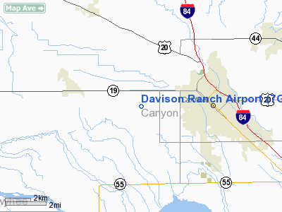
Davison Ranch Airport
Address:
Canyon County, ID
Tel:
208-459-1266
Images
and information placed above are from
http://www.airport-data.com/airport/7GE1/
We
thank them for the data!
| General
Info |
| Country |
United
States |
| State |
IDAHO
|
| FAA ID |
7GE1 |
| Latitude |
43-39-29.575N
|
| Longitude |
116-45-03.504W
|
| Elevation |
2370 feet
|
| Near City |
CALDWELL
|
We don't guarantee the information is fresh and accurate. The data may
be wrong or outdated.
For more up-to-date information please refer to other sources.
|
|


