 |
|
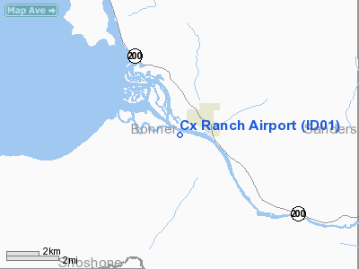
Location
& QuickFacts
|
FAA
Information Effective: |
2007-07-05 |
|
Airport
Identifier: |
ID01 |
|
Airport
Status: |
Operational |
|
Longitude/Latitude: |
116-11-51.6360W/48-08-16.7340N
-116.197677/48.137982 (Estimated) |
|
Elevation: |
2071 ft / 631.24 m (Estimated) |
|
Land: |
0 acres |
|
From
nearest city: |
1 nautical miles SW of Clark Fork, ID |
|
Location: |
Bonner County, ID |
|
Magnetic Variation: |
19E (1985) |
Owner & Manager
|
Ownership: |
Privately owned |
|
Owner: |
James E White |
|
Address: |
Box 158
Clark Fork, ID 83811 |
|
Phone number: |
208-266-1123 |
|
Manager: |
James E White |
|
Address: |
Box 158
Clark Fork, ID 83811 |
|
Phone number: |
208-266-1123 |
Airport Operations and Facilities
|
Airport Use: |
Private |
|
Wind indicator: |
No |
|
Segmented Circle: |
No |
|
Control Tower: |
No |
|
Landing fee charge: |
No |
|
Sectional chart: |
Great Falls |
|
Region: |
ANM - Northwest Mountain |
|
Boundary ARTCC: |
ZSE - Seattle |
|
Tie-in FSS: |
BOI - Boise |
|
FSS on Airport: |
No |
|
FSS Phone: |
208-332-0200 |
|
FSS Toll Free: |
1-800-WX-BRIEF |
Airport Services
|
Airframe
Repair: |
NONE |
|
Power
Plant Repair: |
NONE |
|
Runway Information
Runway 08/26
|
Dimension: |
2400
x 40 ft / 731.5 x 12.2 m |
|
Surface: |
TURF, |
|
|
Runway 08 |
Runway 26 |
|
Traffic
Pattern: |
Left |
Left |
|
Radio Navigation
Aids
|
ID |
Type |
Name |
Ch |
Freq |
Var |
Dist |
|
SZT |
NDB |
Sandpoe |
|
264.00 |
20E |
17.3 nm |
|
LYI |
NDB |
Libby |
|
414.00 |
17E |
29.9 nm |
|
COE |
VOR/DME |
Coeur D'alene |
025X |
108.80 |
19E |
33.3 nm |
|
MLP |
VOR/DME |
Mullan Pass |
125X |
117.80 |
20E |
46.6 nm |
Remarks
- CAUTION:
CATTLE, DEER & GAME BIRDS FREQUENTLY ON RWY.
- ESTABD
PRIOR TO 15 MAY 1959.
Based
Aircraft
|
Aircraft
based on field: |
1 |
|
Single
Engine Airplanes: |
1 |
Cx Ranch Airport
Address:
Bonner County, ID
Tel:
208-266-1123
Images
and information placed above are from
http://www.airport-data.com/airport/ID01/
We
thank them for the data!
| General
Info |
| Country |
United
States |
| State |
IDAHO
|
| FAA ID |
ID01 |
| Latitude |
48-08-16.734N
|
| Longitude |
116-11-51.636W
|
| Elevation |
2071 feet
|
| Near City |
CLARK
FORK |
We don't guarantee the information is fresh and accurate. The data may
be wrong or outdated.
For more up-to-date information please refer to other sources.
|
|


