 |
|
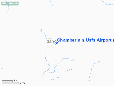
Chamberlain U.S. Forest Service Airport |
|
|
Location
& QuickFacts
|
FAA
Information Effective: |
2007-07-05 |
|
Airport
Identifier: |
U79 |
|
Airport
Status: |
Operational |
|
Longitude/Latitude: |
115-11-48.4070W/45-22-44.6820N
-115.196780/45.379078 (Estimated) |
|
Elevation: |
5765 ft / 1757.17 m (Estimated) |
|
Land: |
55 acres |
|
From
nearest city: |
0 nautical miles E of Chamberlain Guard Station,
ID |
|
Location: |
Idaho County, ID |
|
Magnetic Variation: |
18E (1985) |
Owner
& Manager
|
Ownership: |
Publicly
owned |
|
Owner: |
U S Forest Service |
|
Address: |
324 25th St
Ogden, UT 84401 |
|
Phone
number: |
801-625-5511 |
|
Manager: |
Krassel District Ranger |
|
Address: |
500 North Mission Street
Mc Call, ID 83638 |
|
Phone number: |
208-634-0600 |
Airport Operations and Facilities
|
Airport
Use: |
Open
to public |
|
Wind
indicator: |
Yes |
|
Segmented Circle: |
No |
|
Control
Tower: |
No |
|
Landing
fee charge: |
No |
|
Sectional chart: |
Great Falls |
|
Region: |
ANM - Northwest Mountain |
|
Boundary
ARTCC: |
ZSE - Seattle |
|
Tie-in
FSS: |
BOI - Boise |
|
FSS
on Airport: |
No |
|
FSS
Phone: |
208-332-0200 |
|
FSS
Toll Free: |
1-800-WX-BRIEF |
|
NOTAMs
Facility: |
BOI (NOTAM-d service avaliable) |
Airport Communications
Airport Services
|
Airframe
Repair: |
NONE |
|
Power
Plant Repair: |
NONE |
|
Bottled
Oxygen: |
NONE |
|
Bulk
Oxygen: |
NONE |
|
Runway Information
Runway 07/25
|
Dimension: |
4100
x 200 ft / 1249.7 x 61.0 m |
|
Surface: |
TURF, Good Condition |
|
|
Runway 07 |
Runway 25 |
|
Traffic
Pattern: |
Left |
Left |
|
Obstruction: |
50 ft trees, 105 ft right of centerline |
35 ft tree, 0.0 ft from runway, 110 ft left
of centerline |
|
Runway 15/33
|
Dimension: |
2700
x 140 ft / 823.0 x 42.7 m |
|
Surface: |
TURF, Fair Condition |
|
|
Runway 15 |
Runway 33 |
|
Traffic
Pattern: |
Left |
Left |
|
Obstruction: |
150 ft hill, 1000.0 ft from runway, 200 ft
right of centerline, 7:1 slope to clear |
10 ft trees, 50.0 ft from runway, 5:1 slope
to clear |
|
Radio Navigation
Aids
|
ID |
Type |
Name |
Ch |
Freq |
Var |
Dist |
Remarks
- APRT
SUBJECT TO TEMPORARY CLOSURE EARLY SPRING TO SOFT RYS.
- +70'
TREES ADJACENT TO ALL RY EDGES.
- SOME
RODENT ACTIVITY ON BOTH RYS.
- NO
TELEPHONE AVBL AT ARPT.
- PVT
STONE BREAKER ARPT LOCATED 1 NM NE OF CHAMBERLAIN USFS.
- RY
07/25 W 500 FT CLSD INDEFLY.
- RY
15/33 HAS +2 FT PIPE & -2 FT DITCH ACROSS RY NORTH OF RY 07/25 INTERSECTION.
- EXISTED
PRIOR TO 12/31/58.
Operational
Statistics
Time Period: 2003-09-25
- 2004-09-23
|
Aircraft
Operations: |
77/Week |
|
Air
Taxi: |
37.5% |
|
General
Aviation Itinerant: |
62.5% |
Chamberlain U S Forest Service Airport
Address:
Idaho County, ID
Tel:
801-625-5511,
208-634-0600
Images
and information placed above are from
http://www.airport-data.com/airport/U79/
We
thank them for the data!
| General
Info |
| Country |
United
States |
| State |
IDAHO
|
| FAA ID |
U79 |
| Latitude |
45-22-44.682N
|
| Longitude |
115-11-48.407W
|
| Elevation |
5765 feet
|
| Near City |
CHAMBERLAIN
GUARD STATION |
We don't guarantee the information is fresh and accurate. The data may
be wrong or outdated.
For more up-to-date information please refer to other sources.
|
|


