 |
|
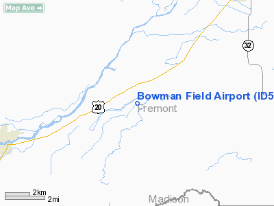
Location
& QuickFacts
|
FAA
Information Effective: |
2007-07-05 |
|
Airport
Identifier: |
ID52 |
|
Airport
Status: |
Operational |
|
Longitude/Latitude: |
111-33-01.8480W/43-59-34.6860N
-111.550513/43.992968 (Estimated) |
|
Elevation: |
5100 ft / 1554.48 m (Estimated) |
|
Land: |
0 acres |
|
From
nearest city: |
1 nautical miles E of Chester, ID |
|
Location: |
Fremont County, ID |
|
Magnetic Variation: |
16E (1985) |
Owner & Manager
|
Ownership: |
Privately owned |
|
Owner: |
Gail Bowman & Marva Bowman |
|
Address: |
Box 35
Chester, ID 83421 |
|
Phone number: |
208-624-4241 |
|
Manager: |
Gail Bowman & Marva Bowman |
|
Address: |
Box 35
Chester, ID 83421 |
|
Phone number: |
208-624-4241 |
Airport
Operations and Facilities
|
Airport
Use: |
Private |
|
Wind
indicator: |
Yes |
|
Segmented Circle: |
No |
|
Control
Tower: |
No |
|
Landing
fee charge: |
No |
|
Sectional chart: |
Salt Lake City |
|
Region: |
ANM - Northwest Mountain |
|
Boundary
ARTCC: |
ZLC - Salt Lake City |
|
Responsible ARTCC: |
ZSE - Seattle |
|
Tie-in
FSS: |
BOI - Boise |
|
FSS
on Airport: |
No |
|
FSS
Phone: |
208-332-0200 |
|
FSS
Toll Free: |
1-800-WX-BRIEF |
|
Runway Information
Runway 03/21
|
Dimension: |
2600
x 30 ft / 792.5 x 9.1 m |
|
Surface: |
TURF, Good Condition |
|
|
Runway 03 |
Runway 21 |
|
Traffic
Pattern: |
Left |
Left |
|
Obstruction: |
30 ft pline, 600.0 ft from runway |
|
|
Radio Navigation
Aids
|
ID |
Type |
Name |
Ch |
Freq |
Var |
Dist |
|
JAC |
FAN MARKER |
Teton |
|
|
17E |
43.3 nm |
|
LO |
NDB |
Targy |
|
415.00 |
16E |
38.2 nm |
|
SWU |
NDB |
Sweden |
|
350.00 |
15E |
42.9 nm |
|
ESY |
NDB |
Yellowstone |
|
338.00 |
17E |
45.8 nm |
|
IDA |
VOR/DME |
Idaho Falls |
85Y |
113.85 |
15E |
36.2 nm |
|
JAC |
VOR/DME |
Jackson |
101X |
115.40 |
13E |
42.0 nm |
|
DBS |
VORTAC |
Dubois |
116X |
116.90 |
15E |
29.0 nm |
Remarks
- CTN:
DURG SPRING BIRDS ON & INVOF ARPT; DOGS INVOF ARPT ALL TIMES.
- CTN:
ARPT CLSD DURG WINT MONTHS.
Based
Aircraft
|
Aircraft
based on field: |
1 |
|
Single
Engine Airplanes: |
1 |
Bowman Field Airport
Address:
Fremont County, ID
Tel:
208-624-4241
Images
and information placed above are from
http://www.airport-data.com/airport/ID52/
We
thank them for the data!
| General
Info |
| Country |
United
States |
| State |
IDAHO
|
| FAA ID |
ID52 |
| Latitude |
43-59-34.686N
|
| Longitude |
111-33-01.848W
|
| Elevation |
5100 feet
|
| Near City |
CHESTER
|
We don't guarantee the information is fresh and accurate. The data may
be wrong or outdated.
For more up-to-date information please refer to other sources.
|
|


