 |
|
|
|
|
|
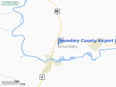
Location
& QuickFacts
|
FAA
Information Effective: |
2007-07-05 |
|
Airport
Identifier: |
65S |
|
Airport
Status: |
Operational |
|
Longitude/Latitude: |
116-17-42.7650W/48-43-32.9550N
-116.295213/48.725821 (Estimated) |
|
Elevation: |
2333 ft / 711.10 m (Estimated) |
|
Land: |
183 acres |
|
From
nearest city: |
2 nautical miles NE of Bonners Ferry, ID |
|
Location: |
Boundary County, ID |
|
Magnetic Variation: |
20E (1985) |
Owner
& Manager
|
Ownership: |
Publicly
owned |
|
Owner: |
Boundary County |
|
Address: |
Po Box 419
Bonners Ferry, ID 83805 |
|
Phone
number: |
208-267-7723 |
|
Manager: |
Dave Parker |
|
Address: |
Hcr 85, Box 139u
Bonners Ferry, ID 83805 |
|
Phone number: |
208-267-3711 |
Airport Operations and Facilities
|
Airport
Use: |
Open
to public |
|
Wind
indicator: |
Yes |
|
Segmented Circle: |
Yes |
|
Control
Tower: |
No |
|
Lighting
Schedule: |
DUSK-DAWN
ACTVT MIRL RY 02/20; VASI RY 20 - CTAF. |
|
Beacon
Color: |
Clear-Green (lighted land airport) |
|
Landing
fee charge: |
No |
|
Sectional chart: |
Great Falls |
|
Region: |
ANM - Northwest Mountain |
|
Boundary
ARTCC: |
ZSE - Seattle |
|
Tie-in
FSS: |
BOI - Boise |
|
FSS
on Airport: |
No |
|
FSS
Phone: |
208-332-0200 |
|
FSS
Toll Free: |
1-800-WX-BRIEF |
|
NOTAMs
Facility: |
BOI (NOTAM-d service avaliable) |
|
Federal Agreements: |
NGY |
Airport Communications
|
CTAF: |
123.000 |
|
Unicom: |
123.000
|
Airport
Services
|
Fuel
available: |
100LLA |
|
Airframe
Repair: |
MAJOR |
|
Power
Plant Repair: |
MINOR |
|
Bottled
Oxygen: |
NONE |
|
Bulk
Oxygen: |
NONE |
|
Runway Information
Runway 02/20
|
Dimension: |
4000
x 75 ft / 1219.2 x 22.9 m |
|
Surface: |
ASPH, Good Condition |
|
Weight
Limit: |
Single wheel: 25000 lbs. |
|
Edge
Lights: |
Medium |
|
|
Runway 02 |
Runway 20 |
|
Longitude: |
116-18-01.2700W |
116-17-24.2600W |
|
Latitude: |
48-43-17.4800N |
48-43-48.4300N |
|
Elevation: |
2311.00 ft |
2333.00 ft |
|
Alignment: |
38 |
127 |
|
Traffic
Pattern: |
Left |
Left |
|
Markings: |
Non-precision instrument, Good Condition |
Non-precision instrument, Good Condition |
|
Crossing
Height: |
0.00 ft |
31.00 ft |
|
VASI: |
|
2-box on left side |
|
Visual
Glide Angle: |
0.00° |
4.00° |
|
Obstruction: |
55 ft trees, 1300.0 ft from runway, 20:1 slope
to clear |
11 ft road, 400.0 ft from runway, 125 ft right
of centerline, 18:1 slope to clear |
|
Radio Navigation
Aids
|
ID |
Type |
Name |
Ch |
Freq |
Var |
Dist |
|
SZT |
NDB |
Sandpoe |
|
264.00 |
20E |
28.2 nm |
|
LYI |
NDB |
Libby |
|
414.00 |
17E |
40.7 nm |
|
ION |
NDB |
Ione |
|
379.00 |
21E |
44.4 nm |
|
EUR |
NDB |
Eureka |
|
392.00 |
20E |
49.7 nm |
Based
Aircraft
|
Aircraft
based on field: |
38 |
|
Single
Engine Airplanes: |
33 |
|
Multi
Engine Airplanes: |
2 |
|
Helicopters: |
3 |
Operational Statistics
Time Period: 2005-06-08
- 2006-06-07
|
Aircraft
Operations: |
52/Day |
|
Air
Taxi: |
2.6% |
|
General
Aviation Local: |
30.7% |
|
General
Aviation Itinerant: |
66.1% |
|
Military: |
0.5% |
Boundary County Airport
Address:
Boundary County, ID
Tel:
208-267-7723,
208-267-3711
Images
and information placed above are from
http://www.airport-data.com/airport/65S/
We
thank them for the data!
| General
Info |
| Country |
United
States |
| State |
IDAHO
|
| FAA ID |
65S |
| Latitude |
48-43-32.955N
|
| Longitude |
116-17-42.765W
|
| Elevation |
2333 feet
|
| Near City |
BONNERS
FERRY |
We don't guarantee the information is fresh and accurate. The data may
be wrong or outdated.
For more up-to-date information please refer to other sources.
|
|


